Search

Search Results

Kaart van Nederlandsch-Indie

event1893

location_onBrunei, Cambodia, Indonesia, Malaysia, Singapore, Thailand, Vietnam, East Timor, Philippines, Southeast Asia

Shipping routes are the focus of this map of the Dutch East Indies, indicated by red lines labelled with the name of the shipping company and the destinations. Parcel shipping routes are also shown. Inset maps feature railway lines too.

Der Indochinesischen Reiche: Birma, Siam, Kambodja und Annam

event1867

location_onCambodia, Laos, Malaysia, Myanmar, Thailand, Vietnam

The route between Saigon and Rangoon taken by the German ethnologist Adolf Bastian is marked on this map of mainland Southeast Asia. There are two inset maps of cites: Mandalay, Amarapura and Ava in Burma; and Bangkok in Siam (including 14 temples).

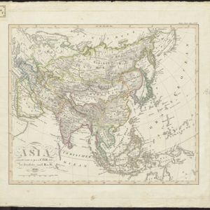
Asia

event1826

location_onBrunei, East Timor, Cambodia, Indonesia, Laos, Malaysia, Myanmar, Papua New Guinea, Philippines, Singapore, Southeast Asia, Thailand, Vietnam

This map of Asia is from the earliest version of ‘Stielers Handatlas’ by the German cartographers Adolf Stieler and Christian Gottlieb Reichard. The maps were initially published separately; later editions compiled them into book form.

close

  • Filter from 1826 to 1893

Current results range from 1826 to 1893