search
search for
search for
search icon
Explore
MapJourneys
Collections
Events
About
Core Team
Search
Search Results
Filter
Detailed Location
Malay Peninsula
close
Remove constraint Detailed Location: Malay Peninsula
Date
1767
close
Remove constraint Date: 1767
View
Gallery
List
Gallery
Map
Sort
Relevance
Relevance
Date (earliest first)
Date (earliest last)
2 Results found
Filter
filter_list
A chart of the seas between the Straits of Banca and Po. Timon: with the eastern part of the Straits of Malacca
event
1767
location_on
Indonesia, Malaysia
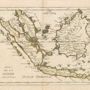
Isles de la Sonde
event
1767
location_on
Brunei, Indonesia, Malaysia, Singapore
close
Refine your results
Collections
check_box_outline_blank
National Library Board Singapore
2
Date
check_box
[remove]
1767
2
Language
check_box_outline_blank
English
1
check_box_outline_blank
French
1
Location
Simple Location
check_box_outline_blank
Indonesia
2
check_box_outline_blank
Malaysia
2
check_box_outline_blank
Brunei
1
check_box_outline_blank
Singapore
1
Detailed Location
check_box
[remove]
Malay Peninsula
2
check_box_outline_blank
Banca
1
check_box_outline_blank
Borneo
1
check_box_outline_blank
Golfe de Siam
1
check_box_outline_blank
Gulf of Thailand
1
check_box_outline_blank
Indian Ocean
1
check_box_outline_blank
Isle de Java
1
check_box_outline_blank
Isle de Sumatra
1
check_box_outline_blank
Isles de la Sonde
1
check_box_outline_blank
Java
1
check_box_outline_blank
Ocean Oriental
1
check_box_outline_blank
Peninsula of Malayo
1
more
Detailed Location
»
Land and Sea Routes
Land Routes
check_box_outline_blank
River
1
Sea Routes
check_box_outline_blank
Bathymetry
1
check_box_outline_blank
Maritime Route
1
Environmental Features
Sea Features
check_box_outline_blank
Reef
1
check_box_outline_blank
Shoal
1
Insets and Attributes
Insets
check_box_outline_blank
Elevation
1
Map Attributes
check_box_outline_blank
Longitude and Latitude
2
check_box_outline_blank
Scale
2
check_box_outline_blank
Rhumbline Network
1
Map Production Details
Map Maker
check_box_outline_blank
Herbert, William
1
check_box_outline_blank
Le Rouge, Georges-Louis
1
Printer/Publisher
check_box_outline_blank
Chez Crepy
1
check_box_outline_blank
William Herbert
1
Place of Publication
check_box_outline_blank
London
1
check_box_outline_blank
Paris
1