Search

Search Results

Hemisphere oriental: dressé en 1720 pour l'usage particulier du Roy sur les observations astronomiques et geographiques

event1724

location_onBrunei, Cambodia, East Timor, Indonesia, Laos, Malaysia, Myanmar, Papua New Guinea, Philippines, Singapore, Southeast Asia, Thailand, Vietnam

This map of the Eastern Hemisphere (Asia, Europe, Africa) shows New Guinea (‘Nouvelle Guinee’) and Australia (‘Nouvelle Hollande’) as one landmass, demonstrating that there was some uncertainty about the area’s geography in the early 18th century.

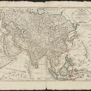
Carte d'Asie: dressée sur les memoires envoyéz par le Czar a l'Academie Royale des Science

event1723

location_onBrunei, Cambodia, East Timor, Indonesia, Laos, Malaysia, Myanmar, Singapore, Philippines, Southeast Asia, Thailand, Vietnam

An early 18th century map of Asia by the French cartographer Guillaume Delisle (1675–1726). Regions are indicated with coloured borders, and the southern part of Borneo is labelled ‘Côte de Mahometans [Coast of the Muslims]’.

Carte d'Asie: dressée sur les memoires envoyéz par le Czar a l'Academie Royale des Science

eventc.1722-1774

location_onBrunei, Cambodia, East Timor, Indonesia, Laos, Malaysia, Myanmar, Philippines, Singapore, Southeast Asia, Thailand, Vietnam

An early 18th century map of Asia by the French cartographer Guillaume Delisle (1675–1726). Regions are indicated with coloured borders, and the southern part of Borneo is labelled ‘Côte de Mahometans [Coast of the Muslims]’.

Carte des Indes et de la Chine

eventc.1722-1774

location_onBrunei, Cambodia, East Timor, Indonesia, Laos, Malaysia, Myanmar, Philippines, Singapore, Southeast Asia, Thailand, Vietnam

This map uses coloured borders to show the ancient kingdoms of Southeast Asia. A label on the island of Borneo states ‘Beajous Idolatres habitans le milieu de l'Isle [Beajous idolaters inhabit the middle of the Island]’.

L'Asie distinguée suivant l'estendue de ses principales parties

event1720

location_onBrunei, Cambodia, East Timor, Indonesia, Laos, Malaysia, Myanmar, Philippines, Southeast Asia, Singapore, Thailand, Vietnam

This two-sheet map of Asia features a decorative cartouche with drawings of two women holding censers (incense burners), two cherubs, and a French coat of arms. On the map, mountains and forests are represented pictorially.

L'Asie divisée en ses principales regions, et ou se peuvent voir l'estendue des Empires, Monarchies, Royaumes, et Estats qui partagent présentement l'Asie

event1720

location_onBrunei, Cambodia, East Timor, Indonesia, Laos, Myanmar, Malaysia, Papua New Guinea, Philippines, Singapore, Southeast Asia, Vietnam, Thailand

This map shows the empires, kingdoms and states of Southeast Asia. Its decorative cartouche features drawings of two women—one with a cornucopia and one with a censer (incense burner)—elephant heads, and a French coat of arms. Nine scales are shown.

L'Asie divisée en ses principales regions, et ou se peuvent voir l'estendue des Empires, Monarchies, Royaumes, et Estats qui partagent présentement l'Asie

event1720

location_onBrunei, Cambodia, East Timor, Indonesia, Laos, Malaysia, Myanmar, Papua New Guinea, Philippines, Singapore, Southeast Asia, Thailand, Vietnam

This map shows the empires, kingdoms and states of Southeast Asia. Its decorative cartouche features drawings of two women—one with a cornucopia and one with a censer (incense burner)—elephant heads, and a French coat of arms. Nine scales are shown.

To the Right Honourable William, Lord Cowper, Lord High Chancellor of Great Britain, this map of Asia

event1720

location_onBrunei, Cambodia, East Timor, Indonesia, Laos, Malaysia, Myanmar, Papua New Guinea, Philippines, Singapore, Southeast Asia, Thailand, Vietnam

Map dedicated to William Cowper, whose coat of arms sits atop the cartouche. It features two horses holding a crest with three martlets (mythical birds used in heraldry). The cartouche also features Asian traders. Monsoons are marked on the map.

Asiae recentissima delineatio, qua Status et Imperia totius Orientis unacum Orientalibus Indiis exhibentur

event1720

location_onBrunei, Cambodia, East Timor, Indonesia, Laos, Malaysia, Myanmar, Philippines, Singapore, Southeast Asia, Thailand, Vietnam

This map's cartouche features an illustration of three men bowing before a ruler on a throne. There is also what was probably meant to be a lion, though the poor likeness suggests it was based on written descriptions rather than real life experience.

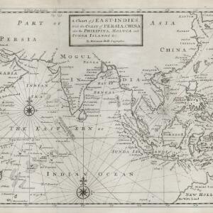
A chart of ye East-Indies with the coast of Persia, China also the Philipina, Moluca and Sunda Islands &c.

event1720

location_onBrunei, Cambodia, East Timor, Indonesia, Laos, Malaysia, Myanmar, Philippines, Singapore, Southeast Asia, Vietnam, Thailand

A map by the influential London cartographer, Herman Moll (1654?—1732), showing Southeast Asia in the context of the wider Asian region. Interestingly, the Strait of Malacca is labelled as the ‘Str. of Sincapora’ (Straits of Singapore).

Carte des Indes, de la Chine & des Iles de Sumatra, Java &c.

event1719

location_onBrunei, Cambodia, East Timor, Indonesia, Laos, Malaysia, Myanmar, Philippines, Singapore, Southeast Asia, Thailand, Vietnam

Text on this map notes that Sumatra is divided into two equal parts by the Equator, so that the days and nights are always the same length. It also notes that Java is ruled by the Dutch, though the Mataram Sultanate in central Java is also mentioned.

close