Search Results

Isole dell'Indie divise in Filippine, Molucche e della Sonda
c.1691-1696
Brunei, Cambodia, East Timor, Indonesia, Laos, Malaysia, Myanmar, Philippines, Singapore, Southeast Asia, Thailand, Vietnam
Dotted lines and colours divide maritime Southeast Asia into three regions on this map: the Philippine archipelago, Maluku Islands and Sunda Islands. The cartouche features cherub mermaids carrying a banner and shield.

Insulæ Indiæ orientalis
1690
Brunei, Cambodia, East Timor, Indonesia, Laos, Malaysia, Myanmar, Philippines, Singapore, Southeast Asia, Thailand, Vietnam
The southern coast of Java ('Iava Maior') on this map is represented by a dotted line, indicating that the exact coastline was unknown at this time. Italian text on the reverse describes the Maluku Islands including Ambon, Banda and Ternate.

Isole dell'India, cioè le Molucche, le Filippine e della Sonda: parte de Paesi di nuoua scoperta e l'Isole de Ladri nel Mare del Zud
1683
Brunei, Cambodia, East Timor, Indonesia, Laos, Malaysia, Myanmar, Papua New Guinea, Philippines, Singapore, Southeast Asia, Thailand, Vietnam
Dotted lines on this late 17th century map demarcate regions and kingdoms (which also have a crown symbol). The cartouche is shaped like a giant shell supported by mermen, with cherubs holding up shells and pearls on top.

Isole dell'Indie divise in Filippine, Molucche e della Sonda
1680
Brunei, Cambodia, East Timor, Indonesia, Malaysia, Laos, Myanmar, Philippines, Singapore, Southeast Asia, Thailand, Vietnam
Dotted lines and colours divide maritime Southeast Asia into three regions on this map: the Philippine archipelago, Maluku Islands and Sunda Islands. The cartouche features cherub mermaids, and a map of mainland Southeast Asia is on the reverse.

Insvlarvm Bandanensivm: novißima delineatio
c.1680-1709
Indonesia
A navigation map of the Banda Islands marked with bathymetry (sea depth), shoals and anchor points. On the island of Goenonghapy (Banda Api), a volcano erupts (‘api’ means ‘fire’ in Indonesian), and there is a military fort (‘Campa Nga’) on Nera.

The Molucca Ilands &c.
c.1680-1700
East Timor, Indonesia, Philippines
From Robert Morden’s ‘Geography Rectified’, a description with maps of the known world in the late 17th century. The map shows the Moluccas, but the text describes the Philippines: Spanish colonial rule, trade, the city of Manila and port of Cavite.

L'Asia
1677
Brunei, Cambodia, East Timor, Indonesia, Laos, Malaysia, Myanmar, Philippines, Southeast Asia, Singapore, Thailand, Vietnam
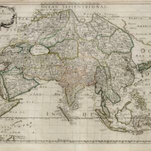
From Giovanni Giacomo de Rossi’s ‘Mercurio Geografico’, this 17th century map of Asia represents mountains, jungles and cities pictorially, with hand-coloured regional borders. The map’s cartouche is decorated with clothing and weaponry.

Asie
1650
Brunei, Cambodia, East Timor, Indonesia, Laos, Malaysia, Myanmar, Philippines, Singapore, Southeast Asia, Thailand, Vietnam
A mid-17th century map of Asia, showing mainland Southeast Asia divided into regions such as Cochinchine, Chiampa and Tunquin (Vietnam), Sian (Thailand), Pegu, Martaban and Arracan (Myanmar), and Camboge (Cambodia).

Carta particolare dell' Isole Celebes è Giliolo parte Austrle. è di Buttō, Batuliar, Timor, Seram, Banda, è Amboina è aItre Isolete
1646
Indonesia, East Timor
This mid-17th century Italian map shows the eastern islands of maritime Southeast Asia. Text on the map refers to winds (‘Venti’), currents (‘Corrente’) and air temperature (‘L'Aria è Calda e Humida [The air is hot and humid]’).
- [remove]Maluku Islands102
- Borneo72
- Sumatra72
- Java67
- Sulawesi60
- Celebes50
- Sunda Islands43
- Malay Peninsula40
- Western New Guinea32
- Malacca26
- East Indies24
- Halmahera24
- more Detailed Location »


