Search

Search Results

Map of the countries between Bengal and China

event1834

location_onIndonesia, Malaysia, Thailand, Vietnam, Cambodia, Laos, Myanmar, Singapore

The location, size, and population (by ethnicity) of Pinang, Malacca and Singapore—the Straits Settlements—are listed, along with how/when they were acquired by Britain. The distances from Canton (China) to those cities, and to India, are also noted.

Strait of Malacca: Sheet 1st

event1812

location_onMalaysia, Indonesia

This map of the Straits of Malacca features shoals and reefs, bathymetry (sea depth), drawings of side views of landmark mountains (elevations) and written observations, all designed to aid navigation.

Le Détroit de Malacca: dressé sur les memoires des plus savans Voyageurs modernes

eventc.1700-1799

location_onMalaysia, Indonesia, Singapore

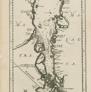
This 18th century map was designed to aid navigation through the Strait of Malacca between Sumatra and the Malay Peninsula. Shoals, reefs and islands are marked, and the numbers printed on the strait record sea depth (bathymetry).

Descripcion de las Indias del Poniente

event1623

location_onBrunei, Cambodia, Indonesia, Philippines, Malaysia, Singapore, Thailand, Vietnam

The many inaccuracies and omissions on this early map of Southeast Asia show the limitations of geographical knowledge at the time. There are some interesting details though, such as a legend listing the small islands in the Moluccas and Philippines.

Nova tabula insularum Iavae, Sumatrae, Borneonis et aliarum Mallaccam usquae

event1598

location_onMalaysia, Indonesia, Singapore

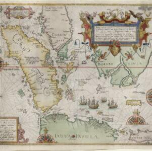
Adapted by Theodore de Bry from an original by Willem Lodewycksz, this map has some inaccuracies e.g. the Malay Peninsula (‘Chersonese’) is completely bisected by the Muar River, leaving the southern tip of the peninsula as a separate island.

Exacta & accurata delineatio cùm orarum maritimarum tùm etiam locorum terrestrium quae in regionibus China, Cauchinchina, Camboia sive Champa, Syao, Malacca, Aracan & Pegu

event1596

location_onBrunei, Cambodia, East Timor, Indonesia, Laos, Malaysia, Myanmar, Philippines, Singapore, Southeast Asia, Thailand, Vietnam

Unusually, north is located to the left of this map of East Asia, rather than the top. The text notes that shallows and reefs are marked, and that the map is based on the explorations of Portuguese ships. Illustrations include sea monsters and ships.

Tabula orientalis regionis, Asiae scilicet extremas complectens terras et regna

event1545

location_onBrunei, Cambodia, East Timor, Indonesia, Laos, Malaysia, Myanmar, Philippines, Singapore, Southeast Asia, Thailand, Vietnam

This 1550 map by the German cartographer Sebastian Münster (1488–1552) was based on the work of the 2nd century geographer Ptolemy. There are many inaccuracies, especially in scale and the locations of mountain ranges, but the region is recognisable.

India extrema, XIX nova tabvla

event1540

location_onBrunei, Cambodia, East Timor, Indonesia, Laos, Malaysia, Myanmar, Philippines, Singapore, Southeast Asia, Thailand, Vietnam

This 1540 map by the German cartographer Sebastian Münster (1488–1552) was based on the work of the 2nd century geographer Ptolemy. On the reverse, there is Latin text giving details of the area, including crops grown.

Tabv moder Indiae

event1535

location_onCambodia, Indonesia, Malaysia, Myanmar, Thailand, Vietnam

Early map of Asia, with the islands of Taprobana (Sumatra) to the west of the Malay Peninsula, and Timonia (Tioman) to the east. Text gives details of local economies: sandalwood on Tioman, and silver and silk at Lamai near Mallaqua (Malacca).

close

  • Filter from 1535 to 1834

Current results range from 1535 to 1834