Search

Search Results

Map of Asia: Printed for the New York Central's 'Four-Track Series'

event1900

location_onMalaysia, Indonesia, Thailand, Myanmar, Cambodia, Vietnam, Papua New Guinea, Philippines, Singapore, Brunei, Laos, Southeast Asia

Colonial territory is labelled and colour-coded on this map of Southeast Asia. A list on the left edge gives the colonial status, size and population of Asian countries, and ranks the main cities by population. Gold and iron mines are marked.

Map of South-Eastern Asia and Northern Australia: showing the districts in Annam and Tonquin which France proposes to annex and to place under a Protectorate, the portion of New Guinea proposed to be acquired by Queensland, and the districts affected by the volcanic eruptions in Java

event1883

location_onSoutheast Asia, Singapore, Thailand, East Timor, Vietnam, Brunei, Cambodia, Indonesia, Laos, Malaysia, Myanmar, Papua New Guinea, Philippines

This 1883 map shows European colonial territories in Southeast Asia. An inset map details the proposed French annexation of Tonquin, Annam and Cochin China (modern Vietnam). International telegraph lines are also marked.

[Manuscript map of Asia and Australia]

event1870

location_onSoutheast Asia, Singapore, Brunei, Cambodia, East Timor, Indonesia, Laos, Malaysia, Myanmar, Papua New Guinea, Philippines, Thailand, Vietnam

On this hand-drawn and coloured map of Asia, the colours differentiate the colonial territories of the European powers: for example, New Guinea is divided into Dutch, British and German areas, and Borneo is split between the British and Dutch.

Asia

event1860

location_onPapua New Guinea, Brunei, Cambodia, Indonesia, Laos, Malaysia, Myanmar, Philippines, Singapore, Southeast Asia, Thailand, Vietnam

This mid-19th century map of Asia has colour-coded borders that show the beginnings of the emergence of the modern nation states of Southeast Asia, such as Laos, Burmah (Burma), Siam (Thailand) and Malaya (Malaysia).

Map of Asia

event1840

location_onBrunei, Cambodia, East Timor, Indonesia, Laos, Malaysia, Myanmar, Papua New Guinea, Philippines, Singapore, Southeast Asia, Thailand, Vietnam

On this mid-19th century map of Asia, national and regional borders are colour-coded, including colonial possessions such at the British Straits Settlements. Coastal cities, islands, shoals and reefs are marked in detail.

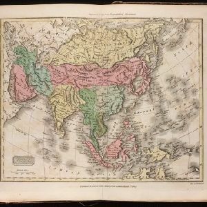
Asia. Engraved for Evans's Geographical Grammar

event1809

location_onBrunei, Cambodia, East Timor, Indonesia, Laos, Malaysia, Myanmar, Papua New Guinea, Philippines, Singapore, Southeast Asia, Thailand, Vietnam

This early 19th century map depicts the regions of Asia by colour. The continental regions are green, while the archipelago regions are red, except for New Guinea which is yellow.

Asia, according to the best Authorities

event1795

location_onBrunei, Cambodia, East Timor, Indonesia, Laos, Malaysia, Myanmar, Philippines, Singapore, Southeast Asia, Thailand, Vietnam

A late 18th century map of Asia with regions divided by colour-coded borders, and detailing rivers, mountains, reefs and shoals.

Bowles's new one-sheet map of Asia, divided into its empires, kingdoms, states, and other subdivisions

event1795

location_onBrunei, Cambodia, East Timor, Indonesia, Laos, Malaysia, Myanmar, Papua New Guinea, Philippines, Singapore, Southeast Asia, Thailand, Vietnam

A late 18th century map of Asia published in London by John Bowles, with regions indicated by colour. Central Borneo is labelled ‘Part inhabited by the Biayos’, which is seen on many contemporary maps, often with the comment ‘a savage people’.

Asia and its islands according to d'Anville

event1787

location_onBrunei, Cambodia, East Timor, Indonesia, Laos, Malaysia, Myanmar, Philippines, Singapore, Southeast Asia, Thailand, Vietnam

This map features labels describing local populations, including the Kemoys ('Savage People') of the mountains of Cokin China (Vietnam), the Biayos of Borneo, and the 'Wild People' of the mountains of Pegu (Myanmar). Top half of the map is missing.

Asia and its islands according to d'Anville

event1787

location_onBrunei, Cambodia, East Timor, Indonesia, Laos, Malaysia, Myanmar, Papua New Guinea, Philippines, Singapore, Southeast Asia, Thailand, Vietnam

A large and detailed late 18th century map of Asia, printed over four sheets. There are labels noting the inhabitants of some areas, such as 'BIAYOS or the inland People' in the centre of Borneo.

Asia: corrected from the observations communicated to the Royal Society at London and the Royal Academy at Paris

event1725

location_onBrunei, Cambodia, East Timor, Indonesia, Laos, Malaysia, Myanmar, Philippines, Singapore, Southeast Asia, Thailand, Vietnam

An early 18th century map of Asia by the English cartographer John Senex, featuring labels noting details of the inhabitants of some areas e.g. on Borneo: ‘The Middle of this Isle is Inhabited by a People call’d Beaujous Idolaters’.

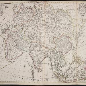
Asia: corrected from the observations communicated to the Royal Society at London and the Royal Academy at Paris

event1708

location_onBrunei, Cambodia, East Timor, Indonesia, Laos, Malaysia, Myanmar, Philippines, Singapore, Southeast Asia, Thailand, Vietnam

An early 18th century map of Asia by the English cartographer John Senex, featuring labels noting details of the inhabitants of some areas e.g. on Borneo: ‘The Middle of this Isle is Inhabited by a People call’d Beaujous Idolaters’.

close

  • Filter from 1670 to 1900

Current results range from 1670 to 1900