Search

Search Results

Carte générale des possessions néerlandaises aux Indes orientales

event1846

location_onBrunei, East Timor, Indonesia, Malaysia, Philippines, Singapore

Map of the Asian colonial possessions of the Netherlands (Dutch East Indies), with an inset of the heights of some of the region’s mountains. A note describes the average temperature, barometer reading and magnetic declination in Batavia at the time.
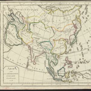

Asie pour La Géographie Comparée: Seconde partie

event1778

location_onBrunei, Cambodia, East Timor, Indonesia, Laos, Malaysia, Myanmar, Papua New Guinea, Philippines, Singapore, Southeast Asia, Thailand, Vietnam

On this map of Asia, New Guinea is shown as two separate islands—the western part as ‘Isle de Papous’ and the eastern part as ‘Nouvelle Guinée’—showing that in the 1770s the details of the region were uncertain.

L'Asie divisée en ses principaux Etats

eventc.1770

location_onBrunei, Cambodia, East Timor, Indonesia, Laos, Malaysia, Myanmar, Philippines, Singapore, Southeast Asia, Thailand, Vietnam

This map shows the empires and kingdoms of Asia. Its decorative cartouche features a drawing of a censer (incense burner) standing on a plinth, surrounded by patterned curtains and carpet. Magellan’s discovery of the Philippines is noted on the map.

L'Asie

event1762

location_onBrunei, Cambodia, East Timor, Indonesia, Laos, Malaysia, Myanmar, Philippines, Singapore, Southeast Asia, Thailand, Vietnam

A hand-written note on the bottom margin of this map reads ‘Dressé par Rizzi Zannoni, gravé par Lattré, 1762’, indicating that it was drawn by the Italian cartographer Giovanni Antonio Rizzi Zannoni, and engraved by the French engraver Jean Lattré.

L'Asie Divisée en ses Grandes Régions et Empires: Subdivisée en ses Principaux Estats

event1759

location_onBrunei, Cambodia, East Timor, Indonesia, Laos, Malaysia, Myanmar, Philippines, Singapore, Southeast Asia, Thailand, Vietnam

Map of the regions, empires and states of Asia. Extensive notes cover religion (people of mainland Southeast Asia are idolaters), colonialism (Dutch and Portuguese rule in Malacca and the Sunda Islands) and the spice trade of the Maluku Islands.

close

  • Filter from 1692 to 1846

Current results range from 1692 to 1846