Search Results

Kaart der residentie Riouw met onderhoorigheden, aangrenzend deel van Sumatra's Westkust en schiereiland Malakka
1871
Indonesia, Malaysia, Singapore
Map of the Riouw (Riau) Residency, Sumatra. The border between Riau and the island’s west coast is marked in red ‘as far as it is known [voor zoo verre die... bekend is]’, ending abruptly in the unexplored mountains near Lake Toba, northern Sumatra.

Kaart van de Residentie Riouw en Onderhoorigheden
1860
Indonesia, Singapore, Malaysia
Map of the Dutch colonial administrative region (residency) of Riouw (Riau) focusing on the islands and sea passages, with bathymetry (sea depth) marked. (From ‘Algemeene Atlas van Nederlandsche Indie [General Atlas of the Dutch East Indies]’.)

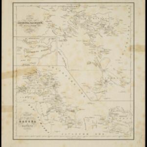
Kaart van den archipel van Riouw, Singapore en Lingga / Kaart van de eilanden Bangka en Blitong
1857
Indonesia, Singapore
Two maps featuring many of the islands between the Malay Peninsula, Sumatra and Borneo. In the top map, Batam, Bintan, Lingga and many of the smaller Riau Islands. In the bottom map, Bangka and Belitung on the east coast of Sumatra.
- Filter from 1857 to 1890
- [remove]District/Administrative Border5
- Colonial Possessions1
- National Border1


