Search

Search Results

A map shewing the various routes proposed for connecting China with India and Europe through Burmah and developing the trade of Eastern Bengal, Burmah and China

event1875

location_onMyanmar, Thailand

A map of proposed trade routes through Burmah (modern Myanmar) intended to connect China to India and Europe. The border between India and Burmah is marked as being ‘unexplored’ and ‘undefined’. A table lists the distances between various cities.

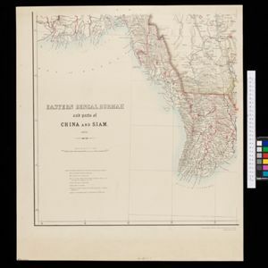
Eastern Bengal, Burmah and parts of China and Siam

event1871

location_onMyanmar, Laos, Thailand, Vietnam

The routes of nine expeditions (1830 to 1869) are marked on this map. There are also short notes about trading (e.g. at Oonoung in Burmah: ‘A bazaar, with a great variety of European goods’), and a list of other maps referenced in producing the map.

The central part of British Burmah with the Shan provinces of Burmah and Siam

event1870

location_onMyanmar, Thailand

The routes of eight expeditions through Burma (Myanmar) and Siam (Thailand) are shown, with text noting ‘Ancient ruins with sarcophagi, mummies’, ‘bazaar… great variety of European goods’, ‘great thoroughfare for the Chinese trading with the Shans’.

close

  • Filter from 1870 to 1875

Current results range from 1870 to 1875