Search

Search Results

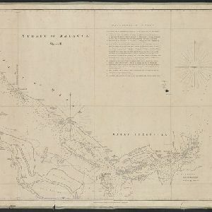
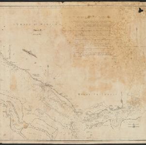
Strait of Malacca: Sheet II

event1823

location_onMalaysia, Singapore, Indonesia

This map of the Straits of Malacca features shoals and reefs, bathymetry (sea depth), drawings of side views of landmark mountains (elevations) and written observations, all designed to aid navigation. Pencil marks indicate the map was actually used.

Strait of Malacca: Sheet II

event1823

location_onMalaysia, Singapore, Indonesia

This map of the Straits of Malacca features shoals and reefs, bathymetry (sea depth), drawings of side views of landmark mountains (elevations) and written observations, all designed to aid navigation.

L'Asie suivant les dernres. observons. des Moscovites

event1747

location_onBrunei, Cambodia, East Timor, Indonesia, Laos, Malaysia, Myanmar, Philippines, Singapore, Southeast Asia, Thailand, Vietnam

The title of this mid-18th century map translates as ‘Asia following the latest observations of the Muscovites/Russians’. Written notes in French list the regions, islands, empires, kingdoms, colonial possessions, religions and languages of Asia.

Partie de la nouvelle Grande Cartes des Indes Orientales, contenant les Isles Maldives, Ceylan, Malacca, Sumatra &c.

event1700

location_onIndonesia, Malaysia, Singapore, Thailand

Sumatra and the Malay Peninsula feature on this map of the Indian Ocean. Enganno Island, west of southern Sumatra, has a label that translates as ‘inhabited by very pernicious savages’. An inset map depicts the Madura Strait between Java and Madura.

close

  • Filter from 1700 to 1823

Current results range from 1700 to 1823