Search Results

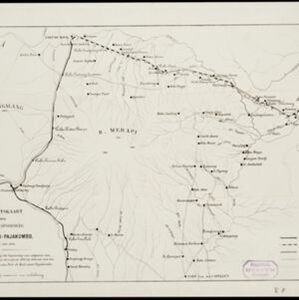
Overzichtskaart van den ontworpen spoorweg Fort de Kock-Pajakombo
1894
Indonesia
A map of railway lines between Fort de Kock (Bukittinggi) and Pajakombo (Payakumbuh) in western Sumatra. The map includes existing line, planned line and rack railway line (a line with a rack and pinion system so it can operate on steep slopes).

Trade Routes in the Far East
1894
Brunei, Cambodia, Indonesia, Laos, Malaysia, Myanmar, Philippines, Singapore, Thailand, Vietnam
Map of stream ship trade routes around Southeast Asia. Rivers, railways, submarine telegraph cables, lighthouses (fixed, revolving and flashing), graving docks and coaling stations are marked. An inset map shows a railway route from Britain to Asia.

Oostkust Sumatra. Schetskaart der Siak Rivier van het Eiland Tengah tot Siak
1894
Indonesia
This late 19th century large-scale (1:30,000) map show just a section of the Siak River, in the Riau province of Sumatra. Bathymetry (water depth) is shown in figures to aid navigation, with various landmarks noted along the river’s banks.


