Search Results

The continent and islands of Asia: with all the latest discoveries
1839
Brunei, Cambodia, East Timor, Indonesia, Laos, Malaysia, Myanmar, Papua New Guinea, Singapore, Philippines, Southeast Asia, Thailand, Vietnam
On this map of Asia, the South China Sea is labelled ‘Malayan Sea’. Small islands, shoals and reefs are shown. A label in Cochin China (Vietnam) reads ‘mountains inhabited by the uncivilized people called Kemoys’.

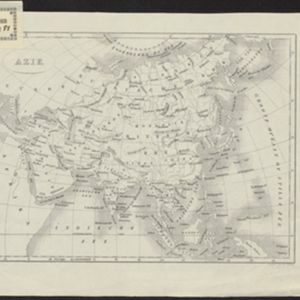
Carte generale de l'Asie: où se trouvent les découvertes faites par Bougainville, Dampier et La Pérouse
1833
Brunei, Cambodia, East Timor, Indonesia, Laos, Malaysia, Myanmar, Papua New Guinea, Philippines, Singapore, Southeast Asia, Thailand, Vietnam
This map of Asia is marked with the routes taken through Southeast Asia by the British Royal Navy captain James Cook, and the French explorer Lapérouse. The title also refers to two other explorers: Louis Antoine de Bougainville and William Dampier.

Asien
c.1820
Brunei, Cambodia, East Timor, Indonesia, Laos, Malaysia, Myanmar, Papua New Guinea, Philippines, Singapore, Southeast Asia, Thailand, Vietnam
On this map of Asia, India and mainland Southeast Asia are labelled together as ‘Ost Indien [East Indies]’. In maritime Southeast Asia, the Sunda Islands are coloured yellow, the Maluku Islands and New Guinea are blue, and the Philippines are red.

Charte von Asien: nach den bewährtesten astronomischen Beobachtungen, den neuesten Reisen, und den vorzüglichsten Charten, insonderheit aber der Geographie des Hrn I.C. Gatterers gemäss
1793
Brunei, Cambodia, East Timor, Indonesia, Laos, Malaysia, Myanmar, Papua New Guinea, Philippines, Singapore, Southeast Asia, Thailand, Vietnam
Map of Asia, with mainland Southeast Asia in red and divided into ancient kingdoms, Sunda Islands in yellow, and the Philippines in grey. Twelve different scales are shown, as different countries used different measurement systems.

Asien nach den neusten und besten Hülfsmitteln entworffen und herausgegeben im Jahre 1793
1793
Brunei, Cambodia, East Timor, Indonesia, Laos, Malaysia, Myanmar, Papua New Guinea, Philippines, Singapore, Southeast Asia, Thailand, Vietnam
On this map of Asia, borders are outlined and cities underlined in different colours to show the colonial territories of the European powers: e.g. at this time, Benkulen (Bencoolen) on the west coast of Sumatra is British, and Malacca is Dutch.

Charte von Asien: nach den bewährtesten astronomischen Beobachtungen, den neuesten Reisen, und den vorzüglichsten Charten, insonderheit aber der Geographie des Hrn I.C. Gatterers gemäss
1793
Brunei, Cambodia, East Timor, Indonesia, Laos, Malaysia, Myanmar, Papua New Guinea, Philippines, Singapore, Southeast Asia, Thailand, Vietnam
Map of Asia, with mainland Southeast Asia in red and divided into ancient kingdoms, Sunda Islands in yellow, and the Philippines in grey. Twelve different scales are shown, as different countries used different measurement systems.

Asien nach den neusten und besten Hülfsmitteln entworffen und herausgegeben im Jahre 1793
1793
Brunei, Cambodia, East Timor, Indonesia, Laos, Malaysia, Myanmar, Papua New Guinea, Philippines, Singapore, Southeast Asia, Thailand, Vietnam
On this map of Asia, borders are outlined and cities underlined in different colours to show the colonial territories of the European powers: e.g. at this time, Benkulen (Bencoolen) on the west coast of Sumatra is British, and Malacca is Dutch.
- Brunei27
- East Timor27
- Indonesia27
- Malaysia27
- [remove]Papua New Guinea27
- Philippines27
- Singapore27
- Cambodia25
- Southeast Asia25
- Thailand25
- Vietnam25
- Laos22
- more Simple Location »
- Java27
- Maluku Islands27
- Sumatra27
- [remove]Sunda Islands27
- Sulawesi26
- Borneo24
- Malay Peninsula22
- Western New Guinea21
- Celebes16
- South China Sea16
- Siam13
- Isles de la Sonde12
- more Detailed Location »


