Search

Search Results

India orientalis, cum adjacentibus insulis

event1740

location_onBrunei, Cambodia, East Timor, Indonesia, Laos, Malaysia, Myanmar, Philippines, Singapore, Southeast Asia, Thailand, Vietnam

This mid-18th century map of Asia features a drawing of religious imagery: Asian people are seen making offerings to two figures, including the Greek god Poseidon (or the Roman god Neptune), and kneeling as cherubs descend from the sky.

Orientaliora Indiarum Orientalium cum insulis adjacentibus à promontorio C. Comorin ad Iapan = Pascaert van t'Ooster gedeelte van Oost Indien van C. Comorin tot Iapan

event1715

location_onBrunei, Cambodia, East Timor, Indonesia, Laos, Malaysia, Myanmar, Philippines, Singapore, Southeast Asia, Thailand, Vietnam

The cartouche on this early 18th century navigation map features the title in Latin and Dutch, as well as a wealth of detailed drawings illustrating the region’s trade: Asian merchants, their goods and animals, and two female European customers.

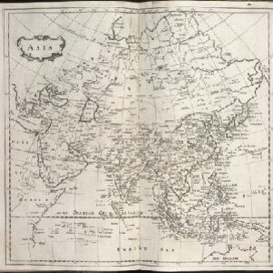
Asia

event1705

location_onBrunei, Cambodia, East Timor, Indonesia, Laos, Malaysia, Myanmar, Philippines, Singapore, Southeast Asia, Thailand, Vietnam

Map of Asia from the second volume of ‘Navigantium atque itinerantium bibliotheca: or, A compleat collection of voyages and travels: consisting of above four hundred of the most authentick writers’ published by John Harris in 1705.

Asiae Nova Descriptio

event1679

location_onBrunei, Cambodia, East Timor, Indonesia, Laos, Malaysia, Myanmar, Philippines, Singapore, Southeast Asia, Thailand, Vietnam

The seas on this early map of Asia are decorated with sailing ships and sea monsters. The cartouche features an illustration of two Asian men carrying bows and arrows.

Oost Indien

event1668

location_onBrunei, Cambodia, East Timor, Indonesia, Laos, Malaysia, Myanmar, Philippines, Singapore, Southeast Asia, Thailand, Vietnam

Map of Asia illustrated with four large allegorical drawings representing the Dutch East India Company, by the Dutch Baroque artist Romeyn de Hooghe. Includes scenes of Asian merchants, the capturing of crocodiles and elephants, and mythology.

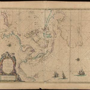
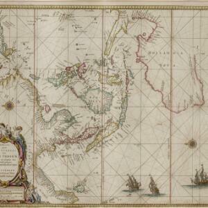
Paskaerte zynde t'Oosterdeel van Oost Indien, met alle de Eylanden daer ontrendt geleegen van C. Comorin tot aen Iapan

event1666

location_onBrunei, Cambodia, East Timor, Indonesia, Laos, Malaysia, Myanmar, Philippines, Singapore, Southeast Asia, Thailand, Vietnam

This map of Southeast Asia features a rhumbline network, a web of lines used to aid navigation. Coastal areas are detailed while interiors are mainly blank, and there are illustrations of sailing ships, reinforcing the maritime focus of this map.

Paskaerte zynde t'Oosterdeel van Oost Indien, met alle de Eylanden daer ontrendt geleegen van C. Comorin tot aen Iapan

event1666

location_onBrunei, Cambodia, East Timor, Indonesia, Laos, Myanmar, Malaysia, Singapore, Philippines, Southeast Asia, Vietnam, Thailand

This map of Southeast Asia features a rhumbline network, a web of lines used to aid navigation. Coastal areas are detailed while interiors are mainly blank, and there are illustrations of sailing ships, reinforcing the maritime focus of this map.

India quae Orientalis dicitur, et insvlae adiacentes

event1664

location_onBrunei, Cambodia, East Timor, Indonesia, Laos, Malaysia, Myanmar, Philippines, Singapore, Southeast Asia, Thailand, Vietnam

French text on the reverse of this map describes the religion, languages, crops, trade etc. of Aracam and Pegu (Myanmar), Siam (Thailand), Cambaja (Cambodia). The map is dedicated to the Dutch merchant Christophoro Thisio.

India quae Orientalis dicitur, et insvlae adiacentes

eventc.1645-1658

location_onBrunei, Cambodia, East Timor, Indonesia, Laos, Malaysia, Myanmar, Philippines, Singapore, Southeast Asia, Thailand, Vietnam

German text on the reverse of this map describes the populations, crops, trade etc. of Sumatra, Borneo, Philippines, and Banda Islands. There are drawings of sailing ships, and the map is dedicated to the Dutch merchant Christophoro Thisio.

close