Search

Search Results

Map of South-Eastern Asia and Northern Australia: showing the districts in Annam and Tonquin which France proposes to annex and to place under a Protectorate, the portion of New Guinea proposed to be acquired by Queensland, and the districts affected by the volcanic eruptions in Java

event1883

location_onSoutheast Asia, Singapore, Thailand, East Timor, Vietnam, Brunei, Cambodia, Indonesia, Laos, Malaysia, Myanmar, Papua New Guinea, Philippines

This 1883 map shows European colonial territories in Southeast Asia. An inset map details the proposed French annexation of Tonquin, Annam and Cochin China (modern Vietnam). International telegraph lines are also marked.

A language map of Further India and the Indian Archipelago

event1878

location_onSoutheast Asia, Brunei, East Timor, Indonesia, Malaysia, Philippines, Singapore, Thailand, Vietnam, Myanmar, Laos, Cambodia

A map of Southeast Asia coloured to indicate the five different language families spoken in the region in the late 19th century. Names of indigenous tribes/languages are marked in red text, with European colonial possessions in grey.

[Manuscript map of Asia and Australia]

event1870

location_onSoutheast Asia, Singapore, Brunei, Cambodia, East Timor, Indonesia, Laos, Malaysia, Myanmar, Papua New Guinea, Philippines, Thailand, Vietnam

On this hand-drawn and coloured map of Asia, the colours differentiate the colonial territories of the European powers: for example, New Guinea is divided into Dutch, British and German areas, and Borneo is split between the British and Dutch.

Asia

event1860

location_onPapua New Guinea, Brunei, Cambodia, Indonesia, Laos, Malaysia, Myanmar, Philippines, Singapore, Southeast Asia, Thailand, Vietnam

This mid-19th century map of Asia has colour-coded borders that show the beginnings of the emergence of the modern nation states of Southeast Asia, such as Laos, Burmah (Burma), Siam (Thailand) and Malaya (Malaysia).

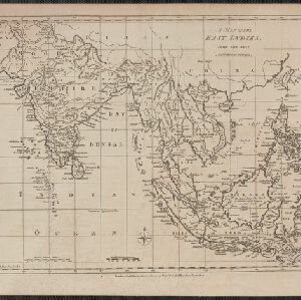
A map of the East Indies

event1780

location_onEast Timor, Southeast Asia, Brunei, Cambodia, Indonesia, Laos, Malaysia, Myanmar, Philippines, Thailand, Vietnam, Singapore

A 19th century map concentrating on Southeast Asia and India. The island of Borneo is annotated with the text 'The Inland Part of this Island is inhabited by the Biayos a savage People'.

Archipel des Indes Orientales: qui comprend les Isles de la Sonde, Moluques et Philippines

event1750

location_onBrunei, Cambodia, East Timor, Indonesia, Malaysia, Philippines, Singapore, Southeast Asia, Thailand, Vietnam

This 18th century map of Southeast Asia by the French cartographer Gilles Robert de Vaugondy features the national borders of the Philippines in green, and of modern Indonesia in yellow. The Malay Peninsula and modern Cambodia and Vietnam are in red.

Carte des Indes Orientalis

event1748

location_onBrunei, Cambodia, East Timor, Indonesia, Laos, Malaysia, Myanmar, Philippines, Singapore, Southeast Asia, Vietnam, Thailand

This mid-18th century map features labels noting the local populations, including the Kemois of the mountains and deserts of Cochinchinae (Vietnam) and the Byayos of Borneo. The map’s cartouche is embellished with maritime and military paraphernalia.

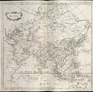
Asia

event1705

location_onBrunei, Cambodia, East Timor, Indonesia, Laos, Malaysia, Myanmar, Philippines, Singapore, Southeast Asia, Thailand, Vietnam

Map of Asia from the second volume of ‘Navigantium atque itinerantium bibliotheca: or, A compleat collection of voyages and travels: consisting of above four hundred of the most authentick writers’ published by John Harris in 1705.

Tabula Indiae Orientalis

event1662

location_onBrunei, Cambodia, East Timor, Indonesia, Laos, Malaysia, Myanmar, Vietnam, Thailand, Southeast Asia, Singapore, Philippines

The cartouche on this mid-17th century map of Asia by the Dutch cartographer Frederik de Wit (c. 1629–1706) is decorated with drawings of Asian men dressed in traditional costume and carrying bows.

close

  • Filter from 1662 to 1883

Current results range from 1662 to 1883