Search

Search Results

Map of Asia

event1840

location_onBrunei, Cambodia, East Timor, Indonesia, Laos, Malaysia, Myanmar, Papua New Guinea, Philippines, Singapore, Southeast Asia, Thailand, Vietnam

On this mid-19th century map of Asia, national and regional borders are colour-coded, including colonial possessions such at the British Straits Settlements. Coastal cities, islands, shoals and reefs are marked in detail.

Nieuwe kaart van het oostelykste deel der weereld, dienende tot aanwyzing van de scheepstogten der Nederlanderen naar Oostindië

event1753

location_onBrunei, Cambodia, East Timor, Indonesia, Laos, Malaysia, Myanmar, Papua New Guinea, Philippines, Singapore, Southeast Asia, Thailand, Vietnam

This map of the Eastern Hemisphere was designed to show maritime routes from the Netherlands to Southeast Asia. It shows New Guinea (‘Nieuw Guinee’) and Australia (‘Nieuw Hollande’) as one landmass, connected via an area labelled ‘Karpentarie’.

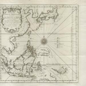
Suite de l'Ocean Oriental contenant les Isles de la Sonde, les costes de Tunquin et de la Chine, les isles du Japon, les Philippines, Moluques

event1746

location_onBrunei, Cambodia, East Timor, Indonesia, Malaysia, Papua New Guinea, Philippines, Singapore, Southeast Asia, Thailand, Vietnam

The coast of New Guinea (‘Nova Guinéa’) is represented in part by a dotted line on this mid-18th century map, indicating that the exact coastlines were unknown at this time. Originally in French, the map has been modified to add Dutch text as well.

Suite de l'Ocean Oriental contenant les Isles de la Sonde, les costes de Tunquin et de la Chine, les isles du Japon, les Philippines, Moluques

event1746

location_onBrunei, Cambodia, East Timor, Indonesia, Malaysia, Papua New Guinea, Philippines, Singapore, Thailand, Vietnam, Southeast Asia

The coast of New Guinea (‘Nouvelle Guinée’) is represented in part by a dotted line on this mid-18th century map, indicating that the exact coastlines were unknown at this time. The western tip is labelled ‘C. de Bonne Esperance [Cape of Good Hope]’.

Insvlæ Indicæ cvm terris circvmvicinis

eventc.1702-1710

location_onVietnam, Myanmar, Papua New Guinea, Philippines, Singapore, Southeast Asia, Thailand, Malaysia, Laos, Indonesia, East Timor, Cambodia, Brunei

The cartouche on this colourful early 18th century map of Southeast Asia is decorated with a wreath, pearls, textiles and an exotic bird. The scale is in German, Spanish, French, Italian and English miles.

close