Search

Search Results

India orientalis

event1658

location_onBrunei, Cambodia, East Timor, Indonesia, Laos, Malaysia, Myanmar, Philippines, Singapore, Thailand, Southeast Asia, Vietnam

This mid-17th century map features three long rivers flowing south through mainland Southeast Asia. Their source is a lake named ‘Chiamai Lacus’, which was one of a number of mythical lakes once thought to exist in southern China.

Asiæ nova delineatio

eventc.1656-1677

location_onBrunei, Cambodia, East Timor, Indonesia, Laos, Malaysia, Myanmar, Philippines, Singapore, Southeast Asia, Thailand, Vietnam

This colourful mid-17th century map was originally published in the Dutch cartographer Nicolaes Visscher's ‘Atlas contractus’. The map is dedicated to D. Henry Spiegel, consul and senator of the city of Amsterdam, and features his coat of arms.

Asiae nova descriptio

event1653

location_onBrunei, Cambodia, East Timor, Indonesia, Laos, Malaysia, Myanmar, Philippines, Southeast Asia, Singapore, Thailand, Vietnam

A mid-17th century map of Asia decorated with a border of drawings of Asian cities and Asian rulers, including the port of Bantam (Banten) at the western end of Java, and a portrait of ‘Rex Moluccae’ the ‘king’ of the Moluccas (Maluku Islands).

Asia antiqua cum finitimis Africae et Europae regionibus

event1652

location_onIndonesia, Malaysia, Brunei, Philippines, Cambodia, Vietnam, Thailand, Laos, Myanmar, Southeast Asia, Singapore

This mid-17th century map of Asia is missing most of the southern and eastern parts of Southeast Asia, such as the Philippines and most of modern Indonesia. Instead, there is a note stating that there are reported to be numerous islands in the area.

L'Asie

event1652

location_onBrunei, Cambodia, East Timor, Indonesia, Laos, Malaysia, Myanmar, Philippines, Singapore, Southeast Asia, Thailand, Vietnam

On this late 17th century map of Asia by the French cartographer Nicolas Sanson, mainland Southeast Asia is labelled ‘PresquIsle de la le Gange [Peninsula of the Ganges]’.

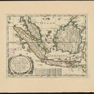
Les Isles de la Sonde: entre lesquelles sont Sumatra, Java, Borneo &c.

eventc.1652

location_onBrunei, Indonesia, Malaysia, Singapore

This mid-17th century map of the Sunda Isles (‘Isles de la Sonde’) includes the Malay Peninsula in addition to Sumatra, Java and Borneo. Mountain ranges and jungles are shown pictorially, and the islands and coasts feature shoals and reefs.

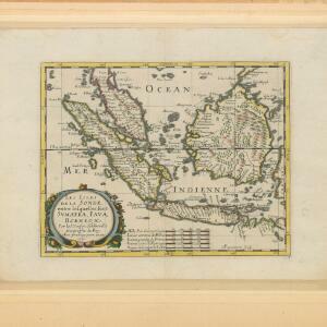
Les Isles de la Sonde: entre lesquelles sont Sumatra, Java, Borneo &c.

event1652

location_onBrunei, Indonesia, Malaysia, Singapore

This mid-17th century map of the Sunda Isles (‘Isles de la Sonde’) includes the Malay Peninsula in addition to Sumatra, Java and Borneo. Mountain ranges and jungles are shown pictorially, and the islands and coasts feature shoals and reefs.

Asie

event1650

location_onBrunei, Cambodia, East Timor, Indonesia, Laos, Malaysia, Myanmar, Philippines, Singapore, Southeast Asia, Thailand, Vietnam

Produced by the French cartographer Nicolas Sanson (1600–1667) in the mid-17th century, this map of Asia features hand-coloured regional borders. Its cartouche features decorative scrollwork, fabric and tassels.

close