Search

Search Results

Carte d'Asie: dressée sur les memoires envoyéz par le Czar a l'Academie Royale des Science

eventc.1750

location_onBrunei, Cambodia, East Timor, Indonesia, Laos, Malaysia, Myanmar, Philippines, Singapore, Southeast Asia, Thailand, Vietnam

An early 18th century map of Asia by the French cartographer Guillaume Delisle (1675–1726). Regions are indicated with coloured borders, and the southern part of Borneo is labelled ‘Côte de Mahometans [Coast of the Muslims]’.

Accuratissima totius Asiæ tabula: In omnes partes divisa

event1750

location_onBrunei, Cambodia, East Timor, Indonesia, Laos, Malaysia, Myanmar, Philippines, Singapore, Southeast Asia, Thailand, Vietnam

A detailed late 17th century map of Asia, showing ancient kingdoms and the place names of important settlements. The cartouche features a drawing of Asian traders selling their goods, while a camel, monkey and two birds look on.

Asia Concinnata Secundum Observationes Academiæ Regalis Scientiarum et nonnullas alias, et juxta annotationes recentissimas

eventc.1750

location_onBrunei, Cambodia, East Timor, Indonesia, Laos, Malaysia, Myanmar, Philippines, Singapore, Southeast Asia, Thailand, Vietnam

This mid-18th century map of Asia features a note stating that there are new features on this map not seen on previous maps, and that this is not a mistake. The cartouche features a column of Asian people riding on horses and camels.

Asia Concinnata Secundum Observationes Academiæ Regalis Scientiarum et nonnullas alias, et juxta annotationes recentissimas

eventc.1750

location_onBrunei, Cambodia, East Timor, Indonesia, Malaysia, Laos, Myanmar, Philippines, Singapore, Southeast Asia, Thailand, Vietnam

This mid-18th century map of Asia features a note stating that there are new features on this map not seen on previous maps, and that this is not a mistake. The cartouche features a column of Asian people riding on horses and camels.

Carte d'Asie: dressée sur les memoires envoyéz par le Czar a l'Academie Royale des Science

eventc.1750

location_onBrunei, Cambodia, East Timor, Indonesia, Laos, Malaysia, Myanmar, Philippines, Singapore, Southeast Asia, Thailand, Vietnam

An early 18th century map of Asia by the French cartographer Guillaume Delisle (1675–1726). Regions are indicated with coloured borders, and the southern part of Borneo is labelled ‘Côte de Mahometans [Coast of the Muslims]’.
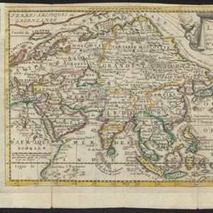

L'Asie Dressée Selon les Observations de Mrs. De l' Academie Royale des Sciences

event1749

location_onBrunei, Cambodia, East Timor, Indonesia, Laos, Malaysia, Myanmar, Singapore, Philippines, Southeast Asia, Thailand, Vietnam

Map of Asia based on observations of members of the French Academy of Sciences. Its decorative cartouche features a drawing of a censer (incense burner).

Carte des Indes Orientales: I. feuille

event1748

location_onMyanmar, Cambodia, Indonesia, Laos, Malaysia, Singapore, Thailand, Vietnam

Map featuring the ancient kingdoms of mainland Southeast Asia. The cartouche is embellished with maritime and military paraphernalia. The map is dedicated to William IV, Prince of Orange (Guillaume Charles Henry Friso). Sheet one of two.

Carte des costes de Cochin Chine, Tunquin, et partie de celles de la Chine

event1747

location_onVietnam, Cambodia

Map of the eastern coast of mainland Southeast Asia (modern Vietnam and part of Cambodia), divided into Tsiampa, Kochinchine and Tunquin. The shoals and reefs of the Paracel Islands are marked. The text is in French and Dutch.

Suite de l'Ocean Oriental contenant les Isles de la Sonde, les costes de Tunquin et de la Chine, les isles du Japon, les Philippines, Moluques

event1746

location_onBrunei, Cambodia, East Timor, Indonesia, Malaysia, Papua New Guinea, Philippines, Singapore, Southeast Asia, Thailand, Vietnam

The coast of New Guinea (‘Nova Guinéa’) is represented in part by a dotted line on this mid-18th century map, indicating that the exact coastlines were unknown at this time. Originally in French, the map has been modified to add Dutch text as well.

close

  • Filter from 1550 to 1900

Current results range from 1550 to 1900