Search Results

Kaart aantoonende districtsgewijs den aard van het grondbezit op Java en Madoera
1895
Indonesia
This map shows Java and Madura divided into regencies which are then subdivided into districts. Each district is coloured to represent land ownership (‘Communaal bezit [Communal property]’) as recorded in 1895.

Kaart van Padang Si Dimpoewan en omstreken
1895
Indonesia
Map of Padang Si Dimpoewan (modern city of Padangsidempuan, northern Sumatra) including a military camp and accommodation, schools, a market, jail and graveyard. Crops are grown in the surrounding area: rice, coconut, coffee, alang-alang, bamboo.

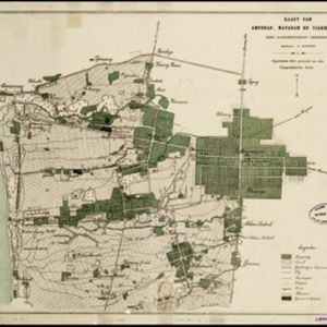
Kaart van Ampenan, Mataram en Tjakranagara met aangrenzend terrein
1895
Indonesia
A map of Mataram in the late 19th century showing it as a kampong (village) surrounded by paddy fields (rectangular parcels of land for growing rice). The map’s whole area is now just part of what is the largest city on the island on Lombok.

Kaart van het Westelijk gedeelte bezet in Groot-Atjèh
1895
Indonesia
This map of Groot-Atjèh (Aceh, northern Sumatra) focuses on the western part occupied during the Aceh War. It shows mountains, wetlands, forests, villages, routes and crops (rice, coconut, banana, sugar, sugarcane, bamboo, alang-alang, betel).

Schetskaart der voormalige Ooster-buitenlinie
1895
Indonesia
Produced during the Aceh War, the ‘Ooster-buitenlinie [Eastern outer line]’ of this map’s title probably refers to Dutch troop positions—marked with flag symbols—along the red road on the left. The road is east of the city of Kota Radja (Banda Aceh).
- Filter from 1522 to 1900
- Dutch597
- French255
- English228
- Latin216
- German101
- Italian32
- Spanish3
- Portuguese1
- more Language »
- [remove]Indonesia1,345
- Malaysia737
- Singapore676
- Brunei621
- Thailand615
- Cambodia594
- Vietnam588
- Philippines583
- Myanmar573
- East Timor558
- Laos549
- Southeast Asia521
- more Simple Location »
- Java845
- Sumatra839
- Borneo687
- Sulawesi553
- Malay Peninsula533
- Celebes475
- Dutch East Indies467
- Maluku Islands373
- Western New Guinea359
- Siam316
- Sunda Islands279
- Malacca247
- more Detailed Location »
- Port166
- Pier74
- Railway Station49
- River934
- Road325
- Path187
- Railway/Tramway121
- Postal Route97
- Canal72
- Bridge50
- Telegraph/Telephone40
- Legend493
- Cartouche386
- Illustration326
- Inset Map286
- Elevation126
- Coat of Arms108


