Search Results

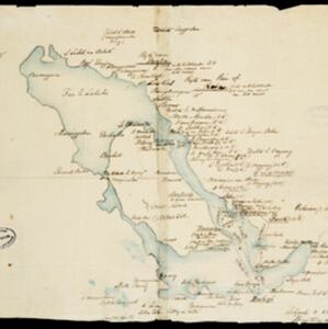
[Omgeving van het Toba meer, afdeelingen Bataklanden, onderafdeelingen Samosir, Toba en Hoogvlakte van Toba]
1890
Indonesia
Hand-drawn map of the southern part of Lake Toba in Sumatra, with roads, rivers and paths marked. Mountains, forest and rice fields are also shown, as are missionary buildings for indigenous and European people.

Kaart der Bataklanden en van het eiland Nijas
1890
Indonesia
A large-scale map of northern Sumatra, spread over 16 sheets, and divided into administrative regions. The island of Nijas (Nias) is marked with the locations of local tribes, and there is a list of other maps referenced in producing the map.

Kaart van Zuid Celebes met uitzondering van het rijk Gowa
1890
Indonesia
Detailed topographical map of South Celebes (Sulawesi) spread over four sheets, featuring crops (coffee, alang-alang, rice), fishing ponds, salt panning. With two additional maps of the island of Saleijer (Selayar) and Pitoempanoewae (Pitumpanua).

Kaart der Bataklanden en van het eiland Nijas
1890
Indonesia
A large-scale map of northern Sumatra, spread over 16 sheets, and divided into administrative regions. The island of Nijas (Nias) is marked with the locations of local tribes, and there is a list of other maps referenced in producing the map.

Topographische Kaart der residentie Bagelen
1890
Indonesia
The residency of Bagelen, Central Java, is shown divided into regencies and districts. Coffee, tea and cinnamon plantations, fields of rice, alang-alang and other crops, mountains, rivers, hot and mineral springs, settlements and routes are marked.

Map of British New Guinea shewing part of Kaiser Wilhelms-Land
1890
Papua New Guinea, Indonesia
Map of British New Guinea showing the boundary with Kaiser-Wilhelmsland (German New Guinea) as agreed on 6th April 1886. The boundary with Dutch New Guinea is also marked. Most detail is around the coast, with the interior left mainly blank.

Oudheidkundige Kaart van West en Midden Java
1890
Indonesia
This map of western and central Java uses red symbols to mark the locations of antiquarian sites, including tjandis (Hindu tombs), walls, terraces, fortifications, temples, wells, statues and cemeteries. Rivers, roads and railways are also shown.
- Filter from 1522 to 1900
- Dutch597
- French255
- English228
- Latin216
- German101
- Italian32
- Spanish3
- Portuguese1
- more Language »
- [remove]Indonesia1,345
- Malaysia737
- Singapore676
- Brunei621
- Thailand615
- Cambodia594
- Vietnam588
- Philippines583
- Myanmar573
- East Timor558
- Laos549
- Southeast Asia521
- more Simple Location »
- Java845
- Sumatra839
- Borneo687
- Sulawesi553
- Malay Peninsula533
- Celebes475
- Dutch East Indies467
- Maluku Islands373
- Western New Guinea359
- Siam316
- Sunda Islands279
- Malacca247
- more Detailed Location »
- Port166
- Pier74
- Railway Station49
- River934
- Road325
- Path187
- Railway/Tramway121
- Postal Route97
- Canal72
- Bridge50
- Telegraph/Telephone40
- Legend493
- Cartouche386
- Illustration326
- Inset Map286
- Elevation126
- Coat of Arms108


