Search

Search Results

Kaart van Oost Indiën: behoorende bij Olivier Land- en zeetogten

event1830

location_onBrunei, Cambodia, East Timor, Indonesia, Laos, Malaysia, Myanmar, Philippines, Singapore, Southeast Asia, Thailand, Vietnam

Map from Johannes Olivier’s book ‘Land- en Zeetogten in Nederland's Indie [Land and Sea Journeys in the Dutch Indies]’, showing European colonial possessions and indigenous kingdoms in Asia.

Carte de l'ile de Java et des autres possessions orientales du Royaume des Pays-Bas

event1830

location_onIndonesia, Malaysia, Philippines, East Timor, Singapore

A French map of the Asian colonial possessions of the Netherlands (Dutch East Indies), with an inset map of the island of Java. Colonies of Britain (Malay Peninsula), Spain (the Philippines) and Portugal (parts of Floris and Timor) are also marked.

Kaart van den Indischen Archipel

event1830

location_onBrunei, Cambodia, East Timor, Indonesia, Laos, Malaysia, Myanmar, Philippines, Singapore, Southeast Asia, Thailand, Vietnam

This map shows the Dutch colonial possessions or dependencies in the East Indies during the early 19th century. Areas not coloured red remained under local rulers or were colonies of other European powers.

East India Isles

event1829

location_onBrunei, Cambodia, East Timor, Indonesia, Laos, Malaysia, Myanmar, Vietnam, Thailand, Southeast Asia, Singapore, Philippines

From ‘Thomson’s New General Atlas’, this mid-19th century map was based on an earlier map by the English cartographer John Cary. It highlights the mountain ranges and rivers of Southeast Asia, and also features many place names.

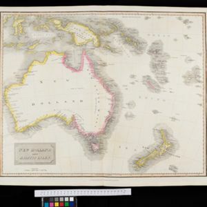
New Holland and Asiatic Isles

event1829

location_onIndonesia, East Timor, Papua New Guinea

Includes part of maritime Southeast Asia. New Guinea is labelled as ‘discovered in 1527’—a reference to the Portuguese explorer Jorge de Menezes—with additional labels describing the terrain (‘Very low land’, ‘Coast is not well known’, ‘An Opening’).

Map of the island of Sumatra constructed chiefly from surveys taken by order of the late Sir Thos. Stamford Raffles

event1829

location_onIndonesia, Malaysia, Singapore

On this map of Sumatra, the west coast mountain ranges contrast with the rivers to the east. An inset map of Singapore focuses on jungles along the coasts, and features bathymetry (sea depth) around the south coast and along the Singapore Strait.

Situatie kaart van het oostelijke gedeelte van de Baai van Batavia met de mondiugen der daar in uitloopende rivieren

event1828

location_onIndonesia

A hand-drawn map of the northern part of Batavia Bay, showing rivers and the city of Batavia (Jakarta). An inset map shows a proposed canal designed to join two parts of the Antjol River.

Plan van de Iris-straat en Triton's-baai

event1828

location_onIndonesia

Hand-drawn map of routes through the Iris-straat (Iris Strait) and Triton’s-baai (Triton Bay) in New Guinea. Bathymetry (sea depth) and reefs are shown, and there is an elevation (side view) of the islands and hills seen at the bay’s entrance.

Prèsqu'ile de Malacca

event1827

location_onMalaysia, Indonesia, Singapore

By Belgian geographer Philippe Vandermaelen (1795–1869), this 19th century map of the Malay Peninsula also features the Riau Islands—including the Anambas and Natuna islands in the South China Sea—the Straits of Malacca and the Singapore Strait.

Carte du Grand Archipel d'Asie (Partie Nord-ouest de l'Océanie)

event1826

location_onSoutheast Asia, Malaysia, Indonesia, Vietnam

Colonial possessions of the Dutch, Spanish and Portuguese, as well as lands of ‘indigenous princes’ are marked with coloured borders on this map of maritime Southeast Asia. Hot springs and mineral water springs in Java are also listed.

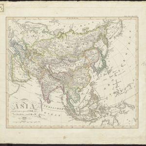
Asia

event1826

location_onBrunei, East Timor, Cambodia, Indonesia, Laos, Malaysia, Myanmar, Papua New Guinea, Philippines, Singapore, Southeast Asia, Thailand, Vietnam

This map of Asia is from the earliest version of ‘Stielers Handatlas’ by the German cartographers Adolf Stieler and Christian Gottlieb Reichard. The maps were initially published separately; later editions compiled them into book form.

close