
Search Results
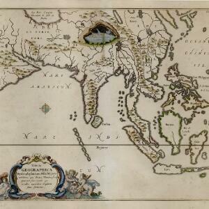
Tabula Geographica Hydrophylacium Asiae Majoris exhibens, quo Omnia Flumina sive proximè sive remotè per occultos meandros Originem suam sortiuntur
1665
Brunei, Cambodia, Indonesia, Laos, Malaysia, Myanmar, Philippines, Singapore, Southeast Asia, Thailand, Vietnam
This map by Athanasius Kircher shows the ‘hydrophylacium’ of Asia, a mythical subterranean ocean that Kircher thought fed rivers and caused tides. Illustrations of Neptune, the god of the sea, and cherubs playing in water continue the aquatic theme.


