Search

Search Results

Chart of East Indian Islands exhibiting the several Passages between the Indian and Pacific Oceans

event1800

location_onBrunei, Cambodia, East Timor, Indonesia, Laos, Malaysia, Myanmar, Philippines, Singapore, Southeast Asia, Thailand, Vietnam

Map focusing on the passages between the islands of maritime Southeast Asia. Many 18th century routes are labelled with the ship/captain’s name and date, and there are notes on some shoals and reefs recording names, details and incidents/shipwrecks.
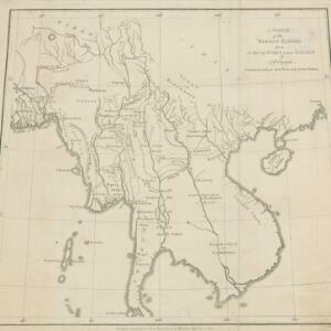
A sketch of the Birman Empire: from a Map of India extra Ganjem

event1800

location_onCambodia, Laos, Myanmar, Thailand, Vietnam

This map from 1800 is by the Scottish cartographer Alexander Dalrymple, who was the first Hydrographer of the British Admiralty. It documents the river systems of the Birman Empire (Myanmar) and modern Thailand, Laos, Cambodia and Vietnam.

close