Search

Search Results

La nouvelle grande carte des Indes Orientales

event1792

location_onCambodia, Laos, Myanmar, Philippines, Thailand, Vietnam

Map of mainland Southeast Asia divided into kingdoms. Larger settlements are marked pictorially with a red building symbol. The desert of Cochinchine (Vietnam) is labelled as being inhabited by the ‘Kemoys Peuples Barbares [Kemoys Barbarian People]’.
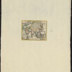
Asia volgens de nieuwste waarnemingen opgesteld

eventc.1790

location_onBrunei, Cambodia, East Timor, Indonesia, Laos, Malaysia, Myanmar, Philippines, Singapore, Southeast Asia, Thailand, Vietnam

A simple hand-coloured map of Asia, with a cartouche of shell, leaves and plants. It shows that in the late 18th century, the details of New Guinea and Australia (‘Nieuw Holland’) were uncertain.

Grundris der stadt und citadelle Batavia

event1785

location_onIndonesia

A plan of the port of Batavia with a detailed legend identifying parts of the city. The sword and laurel wreath of the city’s coat of arms, and the Dutch East India Company flag (marked ‘VOC’ or ‘Vereenigde Oost Indische Compagnie’) are also shown.

Plan der stad en 't kasteel Batavia

event1780

location_onIndonesia

A plan of the port of Batavia with a detailed legend identifying parts of the city. The sword and laurel wreath of the city’s coat of arms, and the Dutch East India Company flag (marked ‘VOC’ or ‘Vereenigde Oost Indische Compagnie’) are also shown.

Carte des Isles de Java, Sumatra, Borneo &a. Les detroits de la Sunde, Malaca, et Banca, Golfe de Siam &a.

event1773

location_onBrunei, Cambodia, Indonesia, Malaysia, Singapore, Thailand, Vietnam, Philippines

This map shows the islands of Java, Sumatra and Borneo, the straits of Sunda, Malacca and Bangka, and the Gulf of Siam. The title is given in both French and Dutch, as are some of the place names on the map.

Carte des Isles de Java, Sumatra, Borneo &a. Les détroits de la Sonde, Malaca et Banca, Golfe de Siam &a.

event1773

location_onBrunei, Cambodia, Indonesia, Malaysia, Singapore, Thailand, Vietnam, Philippines

This map shows the islands of Java, Sumatra and Borneo, the straits of Sunda, Malacca and Bangka, and the Gulf of Siam. The points of the compass can be seen radiating out from a central compass rose.

Carte des Isles de Java, Sumatra, Borneo &a. Les detroits de la Sunde, Malaca, et Banca, Golfe de Siam &a.

event1773

location_onBrunei, Cambodia, Indonesia, Malaysia, Singapore, Thailand, Vietnam, Philippines

This map shows the islands of Java, Sumatra and Borneo, the straits of Sunda, Malacca and Bangka, and the Gulf of Siam. The title is given in both French and Dutch, as are some of the place names on the map.

Batavia

eventc.1772-1780

location_onIndonesia

A plan of the port city of Batavia in the 18th century. Small ships can be seen transporting goods along the river to the pier, and the street plan also includes churches, shopping areas and hospitals, as noted on the map’s detailed legend.

close