Search

Search Results

Kaart van Malang en Omstreken

event1882

location_onIndonesia

Map of the city of Malang, Java, featuring the railway station, military camp, hospital, market etc. The surrounding area has villages, rivers and crops: rice (paddy) fields, coffee, alang-alang, bamboo. Red numbers represent height above sea-level.

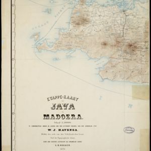
Etappe-kaart van Java en Madoera

event1878

location_onIndonesia

This detailed map of Java and Madura covers four sheets, showing natural features (mountains, lakes, rivers, bays), residential areas (cities, towns, villages) and routes (railways, roads, sea routes). An inset map shows telegraph lines and offices.

Schetskaart van het N.W. gedeelte der Residentie Sumatra's Oostkust

event1877

location_onIndonesia

Rivers and crops are the focus of this map of the northeast coast of Sumatra. Forests and wetlands are marked, as are alang-alang, coconut, pepper, nutmeg and tobacco. Roads are shown as suitable for infantry and light artillery, or for horse riding.

Situatie kaart van een gedeelte der stad Batavia

event1874

location_onIndonesia

Map of the coastline of the bay of Batavia (Jakarta) showing the extension of the port’s pier (in red, labelled CD), the sand and mud bank and bathymetry (sea depth) in the bay, and notes regarding changes in tide levels over the years.

Kaart van de residentie Pekalongan

event1872

location_onIndonesia

Map of the residency of Pekalongan, Central Java, divided into two regencies (Pekalongan and Batang) and 12 districts. The southern half is dominated by mountains, with more towns in the northern half near the sea. Sugar factories are marked.

Kaart van de Hoofdplaats Djokjakarta en Omstreken

event1872

location_onIndonesia

Map of the city of Djokakarta (Yogyakarta, Java), featuring streets and buildings, as well as a military fort, public square and railway station. The surrounding area has rice (paddy) fields and villages.

Schets van een gedeelte van het Haven-kanaal te Batavia

event1871

location_onIndonesia

A hand-drawn plan of part of the ‘Haven Kanaal [Harbour Canal]’ port in Batavia (Jakarta), showing warehouses and other buildings, including a fortified artillery battery. There are two profile drawings of parts of the port’s retaining wall.

Kaart der residentie Banjoemas

event1870

location_onIndonesia

The residency of Banyumas (‘Residentie Banjoemas’) in Central Java is shown divided into regencies (yellow borders) and districts (blue borders) on this map. Cities, towns and villages are marked, as are roads, rivers, paths and postal routes.

Plattegrond der stad Soerabaija

event1867

location_onIndonesia

A mid-19th century map of the city of Soerabaija (Surabaya, East Java, Indonesia) showing its recently built defences, including the ‘Citadel Prins Hendrik’ fort and a walled moat. Outside the city are villages, plantations and fields.

Kaart van de residentie Kadoe

event1867

location_onIndonesia

The residency of Kadoe in Central Java is shown divided into two regencies (yellow border) and 12 districts (blue borders). At the left edge, there are drawings (called elevations) of the side views of the area’s mountains, marked with their heights.

Plattegrond der stad Batavia

event1866

location_onIndonesia

A mid-19th century map of the important port of Batavia (Jakarta), with its pier, commercial centre and residential streets. However, the city is also surrounded by villages (kampongs), fields and plantations. An inset map shows Batavia Castle.

Teekening van de wooning van den aspirant lichtopzigter bij den vuurtoren te Batavia

event1863

location_onIndonesia

An architectural drawing of modifications to be made to a house at the lighthouse in Batavia, consisting of two elevations and a floor plan. The original building is in black, with the new construction in red. It is dated 5th October 1863.

close