Search Results

Particular-see-charte der Strass Sunda, nebst denen darinnen befindlichen insulen und sandbäncken
1744
Indonesia
A navigation map of part of the north coast of Java, featuring the ports of Batavia (Jakarta) and Bantam (Serang). Includes colourful paintings of a ‘menschen fressers [cannibal]’ island, Javanese people and palm trees (dates, banana, coconut).

Royaume de Siam, avec les Royaumes qui luy sont Tributaires, et les Isles de Sumatra, Andemaon etc.
1742
Brunei, Cambodia, Indonesia, Laos, Malaysia, Myanmar, Singapore, Thailand, Vietnam
Map marking the routes through maritime Southeast Asia of two delegations: a French delegation from Brest, France to Siam in 1685; and a Siamese delegation from Siam to Brest in 1686. A note next to Aceh records a sea battle against Portugal in 1616.

Nieuwe afteekeningh van de Noord Küst van Java vertoonende de reede van Batavia en Bantem
1740
Indonesia
A map of the northern coast of Java and the important port cities of Batavia (Jakarta) and Bantem (Banten). The web of lines is a rhumbline network, and shoals, reefs and bathymetry (sea depth) are marked, all to aid navigation.

Chart of the North Coast of Java from Samarang to Batavia
1740
Indonesia
This map uses a variety of methods to aid navigation, including a rhumbline network (a web of lines to help plot routes). The numbers on the sea surface indicate depth (bathymetry), and the drawings of mountains (elevations) were used as landmarks.

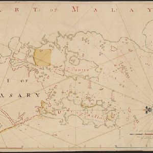
Part of Malaya. Part of Tanasary
1738
Malaysia, Thailand
This map was intended for navigation purposes, with bathymetry (sea depth), reefs, shoals and anchor points marked. One island is labelled ‘like a sugar loaf’, another ‘like a turtel [turtle]’. Oedong Sallang is the island of Phuket, Thailand.

De reede en stadt Batavia, is geleegen aan de noord kust van 't eyland Groot Iava inde Oost Indische Zee
1728
Indonesia
A map of the bay of the port city of Batavia (Jakarta). To aid navigation, a rhumbline network (the web of interconnected lines), bathymetry (sea depth), and small islands, shoals and reefs are marked. An inset map shows the city in more detail.

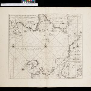
De Straat Sunda in de Oost-Indische Zee tussen de eylanden Sumatra en Iava
1728
Indonesia
Chart of the Sunda Strait, focusing on bays and islands, and showing bathymetry (sea depth), anchor points, shoals and reefs, landmarks, and a rhumbline network, all to aid navigation. Includes an inset map of the bay of the city of Banten on Java.

Nieuwe en zeer naaukeurige kaart van t eyland Java Major of Groot Java: verdeeld in seven byzondere bestekken
1728
Indonesia
On this beautifully illustrated and coloured map of Java, mountains, trees, fields of crops and settlements are shown pictorially. The coasts are marked with shoals, reefs, bathymetry (sea depth, in figures) and anchor points.

Nieuwe en zeer naaukeurige kaart van t eyland Java Major of Groot Java: verdeeld in seven byzondere bestekken
c.1726
Indonesia
On this beautifully illustrated and detailed map of Java, mountains, trees, fields of crops and settlements are shown pictorially. The coasts are marked with shoals, reefs, bathymetry (sea depth, in figures) and anchor points.


