Search

Search Results

Kaart van den Nederlandsch-Indischen Archipel

event1890

location_onIndonesia, East Timor, Brunei, Cambodia, Malaysia, Philippines, Singapore, Southeast Asia, Thailand, Vietnam

The seas of the Dutch East Indies are the focus of this map, with maritime routes, sea temperature, sea depth, currents and monsoons shown. There are graphs of population by ethnicity, agriculture and livestock, trade and shipping, and trade exports.

Java

event1890

location_onIndonesia

This detailed late 19th century map shows Java divided into regencies, and features settlements, roads, railways, rivers, and maritime routes. There is also an inset map of the Kangean Islands.

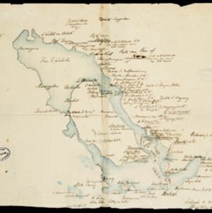
[Toba meer]

event1890

location_onIndonesia

A hand-drawn map of Lake Toba, northern Sumatra, marked with the route of an eight-day journey around the southern lake area—both on land and by boat—starting and ending in the town of Baligé.

Kaart der Bataklanden en van het eiland Nijas

event1890

location_onIndonesia

A large-scale map of northern Sumatra, spread over 16 sheets, and divided into administrative regions. The island of Nijas (Nias) is marked with the locations of local tribes, and there is a list of other maps referenced in producing the map.

close