Search

Search Results

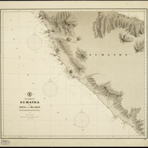
Westkust Sumatra van Roesa tot Melaboe

event1894

location_onIndonesia

Navigation map of the northwest coast of Sumatra. Bathymetry (sea depth), anchor points, shoals and other obstructions (clay, coral, mud, stones, sand) are marked, with hills and settlements to use as landmarks.

Java

event1894

location_onIndonesia

This detailed late 19th century map shows Java divided into regencies, and features mountains, land and sea routes, and an inset map of the port city of Batavia (Jakarta). It was designed to be folded within book covers so it could be easily carried.

Straat Riouw: Trigonometrisch opgenomen door het Engelsche opnemings vaartuig

event1894

location_onIndonesia

Navigation map of the Riau Strait between Batam, Bintan and Rempang (Riau Archipelago). Bathymetry (sea depth), lighthouses, bouys, currents and obstructions are marked. There are side views of islands and mountains (elevations) to use as landmarks.

Koninginne baai met Emma haven

event1894

location_onIndonesia

Map of Koninginne Baai (Bayur Bay, west coast of Sumatra) used to navigate Emma Haven (now Port of Teluk Bayur). It features bathymetry (sea depth), reefs and shoals, as well as lighthouses, buoys and two elevations (side views) of coastal mountains.

Zuidoostkust Borneo

event1894

location_onIndonesia

Designed to aid navigation around the southeast coast of Borneo, this map features bathymetry (sea depth), and is marked with shoals, reefs and other hazards. Mountains (with their heights) and other landmarks along the coasts are also marked.

close