Search

Search Results

Carte de la Côte de Pégou, et de celle de Martaban

event1775

location_onMyanmar

Navigation map of the coast of the ancient kingdom of Pégou and near the town of Martaban (Mottama), Myanmar. Bathymetry (sea depth), anchor points, notes on currents and obstructions are marked, and there are drawings of side views of coastal hills.

Carte de la Côte Orientale du Golfe De Bengale

event1775

location_onMyanmar

Although mainly of India, this map of the Gulf of Bengal includes maritime routes near the west coast of Burma (Myanmar). The web of lines is a rhumbline network, while the numbers indicate sea depth (bathymetry), both used to aid navigation.

Carte de l'Isle de Java, avec les isles de Banca, de Billiton, et une partie de celles de Sumatra et de Borneo

event1775

location_onIndonesia

This 18th century maritime navigation map charts the waters between the islands of Java, Sumatra and Borneo. A route south towards the Sunda Strait, as taken by the French ship Mascarin in March and April 1772, is highlighted.

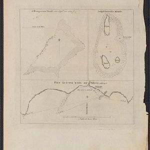
A dangerous shoal seen Septr. the 28, 1767 (Joseph Freewills Islands)

event1773

location_onPhilippines, Indonesia

These three maps are marked with shoals, rocks, water depth, safe entry points, and anchorage locations, to help ships safely anchor. The sites include the Joseph Freewill Islands (Mapia Atoll, Indonesia) and the coast of Mindanao in the Philippines.

A chart of the seas between the Straits of Banca and Po. Timon: with the eastern part of the Straits of Malacca

event1767

location_onIndonesia, Malaysia

This mid-18th century maritime map charts the seas between Peninsula Malaysia and Sumatra, including Singapore—named ‘Po. Panjang’—with the old and new Straits of Singapore marked. The numbers indicate sea depth (bathymetry).

Carte du Cours de la Riviere de Tunquin: depuis Cacho jusqu'à La Mer

event1755

location_onVietnam

Map of the Tunquin River (Red or Hong River) from the city of Cacho (Hanoi, Thailand) to its mouth. At the mouth, bathymetry (sea depth), shoals and anchor points are marked. A place named Hean is labelled as an English and French trading post.

Carte réduite des détroits de Malaca, Sincapour, et du Gouverneur

event1755

location_onMalaysia, Singapore, Indonesia

Maps like this aided navigation through the islands, shoals and reefs of Singapore and the Malacca Strait. Three routes around Singapore are shown, numbers on the sea indicate water depth, and the profile views of mountains were used as landmarks.

Nieuwe kaart van het oostelykste deel der weereld, dienende tot aanwyzing van de scheepstogten der Nederlanderen naar Oostindië

event1753

location_onBrunei, Cambodia, East Timor, Indonesia, Laos, Malaysia, Myanmar, Papua New Guinea, Philippines, Singapore, Southeast Asia, Thailand, Vietnam

This map of the Eastern Hemisphere was designed to show maritime routes from the Netherlands to Southeast Asia. It shows New Guinea (‘Nieuw Guinee’) and Australia (‘Nieuw Hollande’) as one landmass, connected via an area labelled ‘Karpentarie’.

close