Search Results
365 Results found

Algemeene kaart van Nederlandsch Oostindie
c.1839-1855
East Timor, Indonesia, Malaysia, Singapore
This map of the Dutch East Indies is spread over eight sheets, with a hand-drawn cover sheet showing the whole area. There are numerous inset maps of islands, bays, cities etc. Two of the inset maps have a replacement map pasted over them.

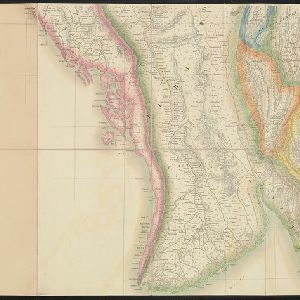
Map of the Eastern Frontier of British India, with the adjacent countries
1838
Myanmar, Thailand
Regional and local borders are colour-coded, with mountains and rivers, settlements, paths/roads and names of local peoples marked. Notes such as ‘Gold dust found in these streams’ and ‘Rich in Tin’ add detail. Only two of four sheets are available.

Situatie kaart van het oostelijke gedeelte van de Baai van Batavia met de mondiugen der daar in uitloopende rivieren
1828
Indonesia
A hand-drawn map of the northern part of Batavia Bay, showing rivers and the city of Batavia (Jakarta). An inset map shows a proposed canal designed to join two parts of the Antjol River.

Map of the River of Don-nai from Cape St. James to the city of Saigon
1820
Vietnam
A map to aid in the navigation of the rivers leading to Saigon (Ho Chi Minh City, Vietnam). Details include bathymetry (water depth), currents, and a side view (or ‘elevation’) of hills to use as a landmark. Tides are described in written remarks.

A map of Java: chiefly from surveys made during the British administration
1817
Indonesia
Made for ‘A History of Java’ by Sir Stamford Raffles, this map includes a list of administrative districts with their populations, and four inset maps of harbours. Another inset map shows rocks and minerals, mountains and volcanoes, and teak forests.

The landing of the British Army at Chillinching on the island of Java 4th Augt. 1811
1815
Indonesia
A map of the landing of British troops at Chillinching (Cilincing, 12 miles to the east of Batavia), part of the 1811 invasion of Java during the Napoleonic Wars. The frigate Leda is at the river mouth, as the British soldiers row to shore.
- Filter from 1544 to 1900
- [remove]Kampong/Village365
- Residential Area128
- Military Fort97
- Cemetery/Columbarium77
- Post Office67
- Temple55
- Church52
- Hospital47
- Military Barracks45
- Mosque36
- Public Space33
- Palace27
- Jail/Prison26
- Police Station23
- more Settlement Features »


