Search Results
793 Results found

Karte von Hoch-Asien: zu C. Ritter's Erdkunde, Buch II, Asien
1833
Myanmar
Four-sheet map of Asia from Carl Ritter’s book ‘Erdkunde [Geography]’, including the northwest Birman Empire (Myanmar) and featuring rivers, mountains, administrative districts and settlements. Plus a page of elevations of Asian mountain ranges.

Carte generale de l'Asie: où se trouvent les découvertes faites par Bougainville, Dampier et La Pérouse
1833
Brunei, Cambodia, East Timor, Indonesia, Laos, Malaysia, Myanmar, Papua New Guinea, Philippines, Singapore, Southeast Asia, Thailand, Vietnam
This map of Asia is marked with the routes taken through Southeast Asia by the British Royal Navy captain James Cook, and the French explorer Lapérouse. The title also refers to two other explorers: Louis Antoine de Bougainville and William Dampier.

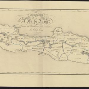
Esquisse de l'ile de Java: divisée en Residences avec indication des chefs-lieux
1833
Indonesia
Map of Java divided into Dutch administrative areas (‘residencies’), and the Empire of Soerakarta and Kingdom of Djokjakarta, which were under indigenous rule (a note records the territories these indigenous areas lost in the Java War (1825–1830)).

Hinterindien
1832
Indonesia, Malaysia, Singapore, Cambodia, Vietnam, Thailand, Myanmar, Laos
A mid-19th century German map of mainland Southeast Asia showing a mixture of ancient kingdoms (e.g. Birma, Siam, Anam) and the colonial possessions of Britain (Malaya, Straits Settlements) and Denmark (Nicobar Islands).

Asien 1831
1831
Brunei, Cambodia, East Timor, Indonesia, Laos, Malaysia, Myanmar, Papua New Guinea, Philippines, Singapore, Southeast Asia, Thailand, Vietnam
On this map of Asia, borders are outlined and cities underlined in different colours to show the colonial territories of the European powers: Russian, British, Dutch, French, Spanish, Portuguese and Danish.

Carte de l'Asie
1831
Brunei, Cambodia, Indonesia, Laos, Malaysia, Myanmar, Philippines, Singapore, Thailand, Vietnam, Southeast Asia
The ancient kingdoms of mainland Southeast Asia are shown on this map of Asia, including the Birman Empire (Myanmar), the Kingdom of Siam (Thailand), and the Empire of Annam (Vietnam).

Ost-Indien mit den Inseln
1831
Brunei, Cambodia, East Timor, Indonesia, Laos, Malaysia, Myanmar, Philippines, Singapore, Southeast Asia, Thailand, Vietnam
On this map of India and Southeast Asia, borders are outlined and cities underlined in different colours to show the colonial territories of the European powers: British, Dutch, Spanish, Portuguese, French and Danish.

Asien 1831
1831
Brunei, Cambodia, East Timor, Indonesia, Laos, Malaysia, Myanmar, Papua New Guinea, Philippines, Singapore, Southeast Asia, Thailand, Vietnam
On this map of Asia, borders are outlined and cities underlined in different colours to show the colonial territories of the European powers: Russian, British, Dutch, French, Spanish, Portuguese and Danish.

Carte de l'Asie
1831
Brunei, Cambodia, Indonesia, Laos, Malaysia, Myanmar, Philippines, Singapore, Thailand, Vietnam, Southeast Asia
The ancient kingdoms of mainland Southeast Asia are shown on this map of Asia, including the Birman Empire (Myanmar), the Kingdom of Siam (Thailand), and the Empire of Annam (Vietnam).
- Indonesia718
- Malaysia364
- Singapore324
- Thailand315
- Brunei301
- Vietnam292
- Cambodia285
- Myanmar285
- Philippines283
- East Timor274
- Laos260
- Southeast Asia238
- more Simple Location »
- Port117
- Pier52
- Railway Station39
- River576
- Road224
- Path123
- Railway/Tramway88
- Postal Route62
- Canal57
- Bridge54
- Telegraph/Telephone24


