Search Results
793 Results found

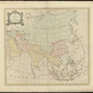
1e. carte de l'Asie
1754
Brunei, Cambodia, East Timor, Indonesia, Laos, Malaysia, Myanmar, Philippines, Singapore, Southeast Asia, Thailand, Vietnam
Simple mid-18th century French-language map of Asia, with Southeast Asia divided into four regions: the mainland in yellow, the Philippines in green, the Sunda Islands in red, and the Maluku Islands in yellow.

Nieuwe kaart van het oostelykste deel der weereld, dienende tot aanwyzing van de scheepstogten der Nederlanderen naar Oostindië
1753
Brunei, Cambodia, East Timor, Indonesia, Laos, Malaysia, Myanmar, Papua New Guinea, Philippines, Singapore, Southeast Asia, Thailand, Vietnam
This map of the Eastern Hemisphere was designed to show maritime routes from the Netherlands to Southeast Asia. It shows New Guinea (‘Nieuw Guinee’) and Australia (‘Nieuw Hollande’) as one landmass, connected via an area labelled ‘Karpentarie’.

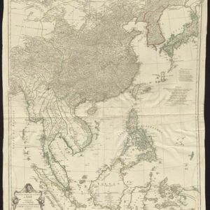
Seconde partie de la carte d'Asie: contenant la Chine et partie de la Tartarie, l'Inde au delà du Gange, les isles Sumatra, Java, Borneo, Moluques, Philippines et du Japon
1752
Vietnam, Myanmar, Malaysia, Philippines, Singapore, Southeast Asia, Thailand, Laos, Indonesia, East Timor, Cambodia, Brunei
Labels on this mid-18th century map of Southeast Asia describe various local peoples as ‘sauvage [savage]’, including the ‘Ke-Moy’ of the mountains along the border of Cochinchine (Vietnam) and Camboja (Cambodia), and the ‘Biayos’ of central Borneo.

Seconde partie de la carte d'Asie: contenant la Chine et partie de la Tartarie, l'Inde au delà du Gange, les isles Sumatra, Java, Borneo, Moluques, Philippines et du Japon
1752
Brunei, Cambodia, East Timor, Indonesia, Laos, Malaysia, Myanmar, Vietnam, Thailand, Southeast Asia, Singapore, Philippines
Labels on this mid-18th century map of Southeast Asia describe various local peoples as ‘sauvage [savage]’, including the ‘Ke-Moy’ of the mountains along the border of Cochinchine (Vietnam) and Camboja (Cambodia), and the ‘Biayos’ of central Borneo.

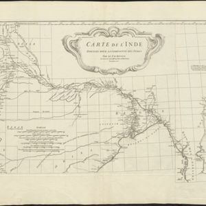
Carte de l'Inde: dressée pour la Compagnie des Indes
1752
Myanmar, Indonesia, Malaysia, Thailand
Spread over two sheets, this map of India also features the west coast of mainland Southeast Asia. There is also an inset map of the bay of Ashem (Banda Aceh, Sumatra), featuring bathymetry (sea depth), islands, shoals and reefs, and anchor points.

Seconde partie de la carte d'Asie: contenant la Chine et partie de la Tartarie, l'Inde au delà du Gange, les isles Sumatra, Java, Borneo, Moluques, Philippines et du Japon
1752
Brunei, Cambodia, East Timor, Indonesia, Laos, Malaysia, Myanmar, Vietnam, Thailand, Southeast Asia, Singapore, Philippines
Labels on this map describe various local peoples as ‘sauvage [savage]’, including the ‘Ke-Moy’ of the mountains along the border of Cochinchine (Vietnam) and Camboja (Cambodia), and the ‘Biayos’ of central Borneo. Top half of map is missing.
- Indonesia718
- Malaysia364
- Singapore324
- Thailand315
- Brunei301
- Vietnam292
- Cambodia285
- Myanmar285
- Philippines283
- East Timor274
- Laos260
- Southeast Asia238
- more Simple Location »
- Port117
- Pier52
- Railway Station39
- River576
- Road224
- Path123
- Railway/Tramway88
- Postal Route62
- Canal57
- Bridge54
- Telegraph/Telephone24


