Search Results

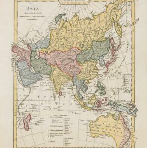
Asia: drawn from the latest astronomical observations
1798
Brunei, Cambodia, East Timor, Indonesia, Laos, Malaysia, Myanmar, Papua New Guinea, Philippines, Singapore, Southeast Asia, Thailand, Vietnam
This late 18th century map of Asia uses colour to differentiate various regions, with mainland Southeast Asia in blue, and maritime Southeast Asia in yellow, red, green and blue.

Les Isles de la Sonde, Moluques, Philippines, Carolines, et Mariannes
1795
Brunei, Cambodia, East Timor, Indonesia, Laos, Malaysia, Myanmar, Philippines, Singapore, Southeast Asia, Thailand, Vietnam
This map of the Sunda Isles (‘Isles de la Sonde’) (with red borders) and Maluku Islands (‘Isles Moluques’) (green borders) also includes mainland Southeast Asia (blue borders), the Philippines (yellow borders) and New Guinea (green borders).

Bowles's new one-sheet map of Asia, divided into its empires, kingdoms, states, and other subdivisions
1795
Brunei, Cambodia, East Timor, Indonesia, Laos, Malaysia, Myanmar, Papua New Guinea, Philippines, Singapore, Southeast Asia, Thailand, Vietnam
A late 18th century map of Asia published in London by John Bowles, with regions indicated by colour. Central Borneo is labelled ‘Part inhabited by the Biayos’, which is seen on many contemporary maps, often with the comment ‘a savage people’.

Chart... Shewing the Connection and respective distances by Sea, between the principal harbours and Settlements in the East Indies
1794
Thailand, Myanmar, Malaysia, Indonesia
Maritime routes had to be adjusted in response to the changing monsoon seasons, as is seen on this late 18th century map of the Indian Ocean. Drawings of the heads of children blowing—called ‘wind-heads’—are used to indicate wind direction.

The coast of India and China from the point and river of Camboja to Canton: comprehending the coasts of Tsiompa and Cochinchina, with the coast of Tonkin and the coast of Koan-Ton, with the isle of Hai-nan
1794
Cambodia, Vietnam
Navigation chart of the east coast of mainland Southeast Asia, from Cambodia to China. Islands, shoals and reefs are marked, along with bathymetry (sea depth). There are seven side views of islands (elevations) to use as landmarks.

A new chart of the straits of Sunda: From the manuscript of the Dutch East India Company
1794
Indonesia
Navigation chart of the Sunda Strait, showing bathymetry (sea depth), shoals and reefs, landmarks, and a rhumbline network. Notes record good anchorages, sources of water and supplies etc. Inset map of the Zutphen Islands off the coast of Sumatra.

A new plan of the Straits, situated to the east of Java & Madura commonly called the Straits of Bali and of Pondi and Respondi
1794
Indonesia
A late 18th century navigation map of the waters between the islands of Java, Madura and Bali. The web of lines is a rhumbline network, the numbers indicate sea depth (bathymetry), and there is an inset map of the Bay of Ballambouang, Java.

Kaart van een Gedeelte der Kust van Cochin-China, met de baai en haven van Turon, en het eiland Kal Lao
1793
Vietnam
A map to aid navigation around the Bay of Turon (location of modern city of Da Nang, Vietnam). Bathymetry (sea depth) is marked, as is the route of the Dutch ship ‘Jackaij’ on her departure from the bay. An elevation view of the land is shown below.

Asie divisée en ses Empires, Royaumes et Etats
1794
Brunei, Cambodia, East Timor, Indonesia, Laos, Malaysia, Myanmar, Philippines, Singapore, Southeast Asia, Thailand, Vietnam
This map of Asia features a decorative cartouche with drawings of two women—one with a cornucopia and one with a censer (incense burner)—and a French coat of arms. Interestingly, the map is dated 1792, during the French Revolution.
- Filter from 1535 to 1900
- Indonesia904
- Malaysia459
- Myanmar427
- Thailand419
- Singapore385
- Vietnam382
- Cambodia359
- Brunei339
- Philippines337
- Laos335
- East Timor295
- Southeast Asia277
- more Simple Location »
- Port173
- Pier74
- Railway Station56
- River884
- Road377
- Path201
- Railway/Tramway177
- Postal Route92
- Canal83
- Bridge69
- Telegraph/Telephone60
- Legend524
- Inset Map276
- Cartouche249
- Illustration189
- Elevation115
- Coat of Arms106


