Search Results
492 Results found

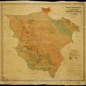
Geognostisch-mijnbouwkundige kaart van het eiland Bangka, distrikt Blinjoe
1872
Indonesia
A geological map showing the types of rock and minerals found in Blinjoe district on the island of Bangka, off the east coast of Sumatra. Deposits of iron, quartz and tin are marked, and coral is shown at the coast.

Kaart van de onderneming Pengging Bangat
1872
Indonesia
Map of an estate/plantation, with land/fields coloured to show their use/crop, and marked in red with their size. The map was made with information from village chiefs, whose villages are marked. A small painting depicts an aqueduct over a river.

Principal Dutch colonies in the Indian seas
1872
Brunei, Indonesia, Malaysia
Two maps of the Dutch East Indies, decorated with drawings of local people and animals. Dutch colonial territory and local sultanates and provinces are highlighted. The heights of Java’s mountains and settlements are displayed in an elevation view.

Topographische kaart der residentie Semarang
c.1869-1871
Indonesia
The residency of Semarang, Central Java, featuring crops (coffee, rice, bamboo, nipa palm); warehouses, cemeteries, post offices; routes, administrative borders; mountains, rivers, forests. An inset map shows updated details of the Kendal district.

Kaart der residentie Riouw met onderhoorigheden, aangrenzend deel van Sumatra's Westkust en schiereiland Malakka
1871
Indonesia, Malaysia, Singapore
Map of the Riouw (Riau) Residency, Sumatra. The border between Riau and the island’s west coast is marked in red ‘as far as it is known [voor zoo verre die... bekend is]’, ending abruptly in the unexplored mountains near Lake Toba, northern Sumatra.

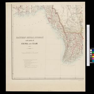
Eastern Bengal, Burmah and parts of China and Siam
1871
Myanmar, Laos, Thailand, Vietnam
The routes of nine expeditions (1830 to 1869) are marked on this map. There are also short notes about trading (e.g. at Oonoung in Burmah: ‘A bazaar, with a great variety of European goods’), and a list of other maps referenced in producing the map.
- Filter from 1670 to 1900
- Port85
- Railway Station44
- Pier33
- [remove]River492
- Road299
- Path187
- Railway/Tramway136
- Postal Route86
- Bridge58
- Canal56
- Telegraph/Telephone46


