Search

Search Results

Skeleton map of the Burma and Assam frontier

event1891

location_onMyanmar

Map of Upper Burma showing the border with Assam (India) and China. The names of indigenous peoples are shown (‘Singphos’), along with the Irrawaddy River, railways and resources (‘Teak Forests’, mines (silver, copper, sulphur, rubies, coal, jade)).

Map to illustrate Report on Frontier Expedition 1890-91

event1891

location_onMyanmar

Map of the border region between northeast Burma (Myanmar) and China's Yunnan Province, spread over two sheets. The Burma side is more detailed, featuring mountains, rivers and settlements, as well as roads and trade routes.

Upper Burma: Preliminary map 1887

event1887

location_onMyanmar

Map of Upper Burma, with the city of Mandalay highlighted in red in the centre, and featuring the Irrawaddy and Chindwin rivers, roads and settlements. Mountains, forests and mines (coal, silver, rubies, amber) are marked.

Skeleton map of the Burma and Assam frontier

event1886

location_onMyanmar

Map of Upper Burma showing the border with Assam (India) and China. The names of indigenous peoples are shown (‘Singphos’), along with the Irrawaddy River, railways and resources (‘Teak Forests’, mines (silver, copper, sulphur, rubies, coal, jade)).

Sketch map showing forest reserves (sanctioned and proposed) in the Pegu and Tenasserim Divisions of British Burma

event1881

location_onMyanmar

Map of forest reserves—sanctioned and proposed—on the west coast of British Burma (Myanmar). The map also shows rivers, including the Irrawaddy River, and the railway from Rangoon (Yangon) to Prome (Pyay).

Karte von Hoch-Asien: zu C. Ritter's Erdkunde, Buch II, Asien

event1833

location_onMyanmar

Four-sheet map of Asia from Carl Ritter’s book ‘Erdkunde [Geography]’, including the northwest Birman Empire (Myanmar) and featuring rivers, mountains, administrative districts and settlements. Plus a page of elevations of Asian mountain ranges.

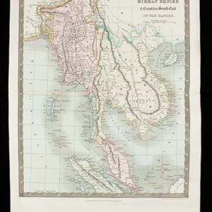
Birman Empire & countries south east of the Ganges

event1831

location_onCambodia, Indonesia, Laos, Malaysia, Myanmar, Thailand, Vietnam

This map of mainland Southeast Asia is divided into colour-coded regions. The Birman Empire (Myanmar) is the most detailed, with internal regions, rivers including the Irrawaddy, mountains and settlements marked.

close

  • Filter from 1831 to 1899

Current results range from 1831 to 1899