Search Results

Geologische übersichts- und vulkan-karte von Java und Madura
1898
Indonesia
Geological map of Java and Madura, showing rock types and the locations of volcanoes. There are two cross sections (elevations) showing the heights of terrain: one of Java; and one from Cambodia to the Indian Ocean, including Borneo and Java.

Voorontwerp eener spoorweghaven te Soerabaia
1897
Indonesia
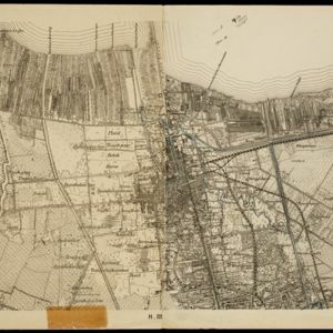
Spread over four sheets, this is a detailed hand-drawn plan for railway and tramway lines at the port of Soerabaia (Surabaya, East Java). It includes a railway station, commercial areas, housing, customs, warehouses, offices and government buildings.

Topographische kaart der residentie Bantam
1897
Indonesia
The residency of Bantam, West Java, shown over nine sheets. Coffee and tea plantations, fields of rice, alang-alang, bamboo and other crops are marked. Inset maps show distances by road and path, and the area divided into regencies and districts.

Atlas van Nederlandsch Oost-Indië
c.1897-1904
Indonesia
Very detailed atlas of the entire Dutch East Indies, over 16 map sheets, with a cover and overview map. Includes topographic maps, inset maps of cities and islands, and maps featuring land and sea routes, languages, geology, colonial territory etc.

Topographische Kaart der residentie Bantam
1897
Indonesia
The residency of Bantam, West Java, shown over nine sheets. Coffee and tea plantations, fields of rice, alang-alang, bamboo and other crops are marked. Inset maps show distances by road and path, and the area divided into regencies and districts.

Topographische Kaart der residentie Batavia
1897
Indonesia
The residency of Batavia, West Java, featuring plantations (coffee, tea, coconut, cinnamon, nutmeg, sugar); crops (rice, alang-alang, bamboo); fishing ponds; factories, warehouses, shops; routes, administrative borders; mountains, rivers, lakes.

Kaart van den Nederlandsch Oost Indischen archipel aantoonende de door de Inlandsche bevolking beleden godsdiensten
1896
Indonesia
A map of the religions of the local peoples of the Dutch East Indies, with areas marked as Christian, Muslim, ‘heathen’. With population figures, including for Protestants and Catholics, and locations of missionaries and other religious teachers.

Route chart to India and the East
1895
Brunei, Cambodia, East Timor, Indonesia, Laos, Malaysia, Myanmar, Philippines, Singapore, Southeast Asia, Thailand, Vietnam
Map of Asia featuring steamship routes—including around Southeast Asia—connecting ports such as Penang, Singapore, Batavia (Jakarta), Saigon, Bangkok, Rangun (Yangon), Manila, Macassar (Makassar) etc. There is also an inset map of Singapore.
- Filter from 1535 to 1900
- Dutch321
- French179
- Latin171
- English154
- German62
- Italian21
- Spanish2
- Portuguese1
- more Language »
- Indonesia845
- Malaysia563
- Singapore550
- Brunei537
- East Timor510
- Philippines506
- Thailand494
- Cambodia492
- Vietnam485
- Southeast Asia467
- Myanmar461
- Laos457
- more Simple Location »
- [remove]Java846
- Sumatra600
- Borneo567
- Sulawesi471
- Malay Peninsula429
- Celebes402
- Western New Guinea319
- Maluku Islands309
- Siam262
- Sunda Islands247
- Dutch East Indies235
- Malacca212
- more Detailed Location »
- Port124
- Pier64
- Railway Station29
- River582
- Road173
- Path90
- Postal Route88
- Railway/Tramway63
- Canal61
- Bridge24
- Telegraph/Telephone20


