Search

Search Results

Carte des Routes dans l'Océan Indien

eventc.1849-1863

location_onBrunei, Cambodia, East Timor, Indonesia, Laos, Malaysia, Myanmar, Papua New Guinea, Philippines, Singapore, Southeast Asia, Thailand, Vietnam

Map of the Indian Ocean showing maritime routes, including some to and around Southeast Asia, where they pass through the Strait of Malacca, the Sunda Strait, and the straits between the Lesser Sunda Islands.

A chart of the Indian and Pacific Oceans with particular plans of the harbours

event1847

location_onBrunei, Cambodia, East Timor, Indonesia, Laos, Malaysia, Myanmar, Papua New Guinea, Philippines, Southeast Asia, Singapore, Thailand, Vietnam

Southeast Asia is shown on sheets two and three of this 12-sheet map of the Indian and Pacific oceans, including detailed inset maps of the straits of Singapore, Bangka, Gaspar and Sunda, with bathymetry (sea depth), shoals, reefs, anchorages etc.

Carte des possessions et etablissemens du Roi des Pays-Bas aux Indes Orientales

event1839

location_onBrunei, East Timor, Indonesia, Malaysia, Singapore

Map of the Dutch East Indies featuring maritime routes from the Sunda Strait and Batavia (Jakarta) to the Maluku or Spice Islands (Ambon, Ternate etc.). There is an eastern route (taken from October to March) and a return route (December to March).

Carte de l'Archipel des Indes Orientales, représentant les différens passages entre l'Ocean Indien et le Grand Océan

eventc.1804

location_onBrunei, Cambodia, East Timor, Indonesia, Laos, Malaysia, Myanmar, Philippines, Singapore, Southeast Asia, Thailand, Vietnam

Map focusing on the passages between the islands of maritime Southeast Asia used to travel between the Indian and Pacific oceans. Includes the Strait of Malacca, many straits between the Sunda Islands, and a route through the Maluku Islands.

Chart of East Indian Islands exhibiting the several Passages between the Indian and Pacific Oceans

event1800

location_onBrunei, Cambodia, East Timor, Indonesia, Laos, Malaysia, Myanmar, Philippines, Singapore, Southeast Asia, Thailand, Vietnam

Map focusing on the passages between the islands of maritime Southeast Asia. Many 18th century routes are labelled with the ship/captain’s name and date, and there are notes on some shoals and reefs recording names, details and incidents/shipwrecks.

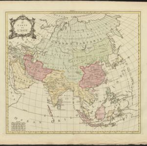
2e. carte de l'Asie

event1755

location_onBrunei, Cambodia, East Timor, Indonesia, Laos, Malaysia, Myanmar, Philippines, Singapore, Southeast Asia, Thailand, Vietnam

Mid-18th century French-language map of Asia, with Southeast Asia divided into four regions: the mainland in yellow, the Philippines in green, the Sunda Islands in red, and the Maluku Islands in yellow.

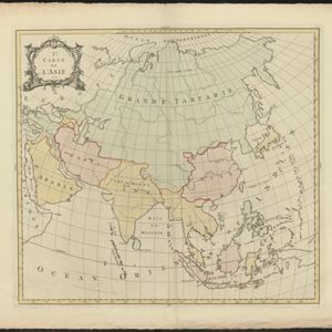
1e. carte de l'Asie

event1754

location_onBrunei, Cambodia, East Timor, Indonesia, Laos, Malaysia, Myanmar, Philippines, Singapore, Southeast Asia, Thailand, Vietnam

Simple mid-18th century French-language map of Asia, with Southeast Asia divided into four regions: the mainland in yellow, the Philippines in green, the Sunda Islands in red, and the Maluku Islands in yellow.

close